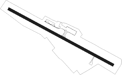
Bauru
Airport details
| Country | Brazil |
| State | São Paulo |
| Region | SB |
| Airspace | Brasilia Ctr |
| Municipality | Bauru |
| Elevation | 2021ft (616m) |
| Timezone | GMT -3 |
| Coordinates | -22.34838, -49.05016 |
| Magnetic var | |
| Type | land |
| Available since | X-Plane v10.40 |
| ICAO code | SBBU |
| IATA code | BAU |
| FAA code | n/a |
Communication
| Bauru ATIS | 127.875 |
| Bauru Tower | 121.300 |
| Bauru Approach | 121.300 |
| Bauru Departure | 121.300 |
Runway info
| Runway 14 / 32 | ||
| length | 1513m (4964ft) | |
| bearing | 121° / 301° | |
| width | 35m (115ft) | |
| surface | asphalt | |
| displ threshold | 200m (656ft) / 10m (33ft) | |
Nearby beacons
| code | identifier | dist | bearing | frequency |
|---|---|---|---|---|
| BRU | BAURU NDB | 3.7 | 301° | 380 |
| ARE | AREALVA NDB | 10.8 | 354° | 340 |
| MRA | MARILIA NDB | 49.7 | 280° | 415 |
| AAQ | ARARAQUARA NDB | 60 | 60° | 205 |
Departure and arrival routes
| Transition altitude | 5000ft |
| SID end points | distance | outbound heading | |
|---|---|---|---|
| RW14 | |||
| CAYA1A | 42mi | 59° | |
| RW32 | |||
| EPLA1A | 42mi | 59° | |
Instrument approach procedures
| runway | airway (heading) | route (dist, bearing) |
|---|---|---|
| RW14-Z | BU013 (112°) | BU013 5000ft BU012 (5mi, 107°) 4000ft |
| RW14-Z | BU014 (85°) | BU014 5000ft BU012 (6mi, 19°) 4000ft |
| RNAV | BU012 4000ft BU011 (5mi, 107°) 3660ft BU015 (3mi, 121°) 2750ft SBBU (3mi, 122°) 2060ft BU016 (5mi, 120°) BU018 (10mi, 136°) 5000ft BU018 (turn) 5000ft | |
| RW32-Z | BU018 (310°) | BU018 5000ft BU017 (5mi, 316°) 4000ft |
| RW32-Z | BU019 (342°) | BU019 5000ft BU017 (6mi, 50°) 4000ft |
| RNAV | BU017 4000ft BU016 (5mi, 316°) 3670ft BU001 (3mi, 301°) 2760ft SBBU (2mi, 299°) 2072ft BU011 (6mi, 302°) BU013 (10mi, 287°) 5000ft BU013 (turn) 5000ft |
Disclaimer
The information on this website is not for real aviation. Use this data with the X-Plane flight simulator only! Data taken with kind consent from X-Plane 12 source code and data files. Content is subject to change without notice.
