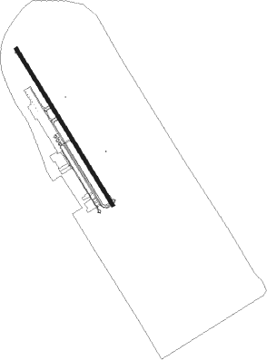
Cuiabá - Marechal Rondon Intl
Airport details
| Country | Brazil |
| State | Mato Grosso |
| Region | SB |
| Airspace | Amazonica Ctr |
| Municipality | Várzea Grande |
| Elevation | 617ft (188m) |
| Timezone | GMT -4 |
| Coordinates | -15.65298, -56.11667 |
| Magnetic var | |
| Type | land |
| Available since | X-Plane v10.40 |
| ICAO code | SBCY |
| IATA code | CGB |
| FAA code | n/a |
Communication
| Marechal Rondon Intl CUIABA ATIS | 127.850 |
| Marechal Rondon Intl CUIABA Ground Control | 121.900 |
| Marechal Rondon Intl CUIABA Tower | 118.100 |
| Marechal Rondon Intl CUIABA Approach | 120.350 |
| Marechal Rondon Intl CUIABA Approach | 119.400 |
Approach frequencies
| ILS-cat-I | RW35 | 109.3 | 18.00mi |
| 3° GS | RW35 | 109.3 | 18.00mi |
Nearby beacons
| code | identifier | dist | bearing | frequency |
|---|---|---|---|---|
| CIA | CUIABA VOR/DME | 0.3 | 124° | 113.70 |
Departure and arrival routes
| Transition altitude | 4000ft |
| SID end points | distance | outbound heading | |
|---|---|---|---|
| RW17 | |||
| ISVI1B | 40mi | 99° | |
| IROD1B | 125mi | 163° | |
| EDPU1B | 40mi | 253° | |
| RW35 | |||
| KULI1A | 114mi | 0° | |
| XUVU1A | 40mi | 99° | |
| ENRA1A | 40mi | 253° | |
| STAR starting points | distance | inbound heading | |
|---|---|---|---|
| RW17 | |||
| ATED1B | 24.0 | 117° | |
| EQUA1B | 113.8 | 180° | |
| SINI1B | 101.9 | 302° | |
| ANGA1B | 54.3 | 343° | |
| RW35 | |||
| ATED1A | 24.0 | 117° | |
| EQUA1A | 113.8 | 180° | |
| SINI1A | 101.9 | 302° | |
| ANGA1A | 54.3 | 343° | |
Instrument approach procedures
| runway | airway (heading) | route (dist, bearing) |
|---|---|---|
| RW17-Z | CY007 (152°) | CY007 4000ft CY011 (5mi, 152°) 2600ft |
| RW17-Z | CY013 (122°) | CY013 4000ft CY011 (6mi, 63°) 2600ft |
| RW17-Z | CY014 (182°) | CY014 4000ft CY011 (6mi, 243°) 2600ft |
| RNAV | CY011 2600ft CY012 (5mi, 152°) 2280ft SBCY (6mi, 152°) 667ft CY001 (16mi, 152°) 4000ft CY001 (turn) 4000ft | |
| RW35 | CY001 (332°) | CY001 4000ft UDUNU (5mi, 332°) 2600ft |
| RW35 | LIXAP (2°) | LIXAP 4000ft UDUNU (6mi, 63°) 2600ft |
| RW35 | UBDON (302°) | UBDON 4000ft UDUNU (6mi, 243°) 2600ft |
| RNAV | UDUNU 2600ft XODUP (5mi, 332°) 2230ft SBCY (6mi, 332°) 639ft CY007 (16mi, 332°) 4000ft CY007 (turn) 4000ft |
Holding patterns
| STAR name | hold at | type | turn | heading* | altitude | leg | speed limit |
|---|---|---|---|---|---|---|---|
| ANGA1A | NEKET | VHF | right | 174 (354)° | 1.0min timed | ICAO rules | |
| ANGA1B | NEKET | VHF | right | 174 (354)° | 1.0min timed | ICAO rules | |
| ATED1A | ATEDO | VHF | right | 309 (129)° | 1.0min timed | ICAO rules | |
| ATED1B | AMZAK | VHF | left | 338 (158)° | 1.0min timed | ICAO rules | |
| ATED1B | TENEL | VHF | right | 312 (132)° | 1.0min timed | ICAO rules | |
| EQUA1A | CY014 | VHF | left | 18 (198)° | 1.0min timed | ICAO rules | |
| EQUA1B | DORNO | VHF | right | 18 (198)° | 1.0min timed | ICAO rules | |
| SINI1A | EDPOT | VHF | left | 141 (321)° | 1.0min timed | ICAO rules | |
| SINI1B | EDPOT | VHF | left | 141 (321)° | 1.0min timed | ICAO rules | |
| *) magnetic outbound (inbound) holding course | |||||||
Disclaimer
The information on this website is not for real aviation. Use this data with the X-Plane flight simulator only! Data taken with kind consent from X-Plane 12 source code and data files. Content is subject to change without notice.
