Florianópolis - Hercillo Luz Intl
Airport details
| Country | Brazil |
| State | Santa Catarina |
| Region | SB |
| Airspace | Curitiba Ctr |
| Municipality | Florianópolis |
| Elevation | 19ft (6m) |
| Timezone | GMT -3 |
| Coordinates | -27.67133, -48.54078 |
| Magnetic var | |
| Type | land |
| Available since | X-Plane v10.40 |
| ICAO code | SBFL |
| IATA code | FLN |
| FAA code | n/a |
Communication
| Hercillo Luz Intl ATIS | 127.450 |
| Hercillo Luz Intl Ground ControlC | 121.700 |
| Hercillo Luz Intl Tower (Mil) | 122.800 |
| Hercillo Luz Intl Tower | 118.700 |
| Hercillo Luz Intl Approach | 119.650 |
| Hercillo Luz Intl Approach | 128.950 |
| Hercillo Luz Intl Approach | 129.450 |
Approach frequencies
| ILS-cat-I | RW14 | 110.3 | 18.00mi |
| 3° GS | RW14 | 110.3 | 18.00mi |
Nearby Points of Interest:
Ribeirão da Ilha
-Edifício da Alfândega
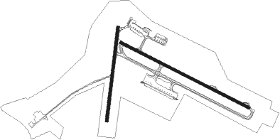
Runway info
Runway 14 / 32  | ||
| length | 2301m (7549ft) | |
| bearing | 118° / 298° | |
| width | 45m (148ft) | |
| surface | asphalt | |
| blast zone | 0m (0ft) / 162m (531ft) | |
| Runway 03 / 21 | ||
| length | 1507m (4944ft) | |
| bearing | 13° / 193° | |
| width | 45m (148ft) | |
| surface | asphalt | |
| displ threshold | 179m (587ft) / 142m (466ft) | |
Nearby beacons
| code | identifier | dist | bearing | frequency |
|---|---|---|---|---|
| FLN | FLORIANOPOLIS VOR/DME | 0 | 13° | 113.40 |
| BIG | DME | 5.7 | 298° | 113.70 |
Departure and arrival routes
| Transition altitude | 6000ft |
| Transition level | 60ft |
| SID end points | distance | outbound heading | |
|---|---|---|---|
| RW14 | |||
| PUNO3A | 60mi | 18° | |
| OMNI | 61mi | 206° | |
| OGPI2A | 40mi | 218° | |
| RW32 | |||
| BODO1B | 60mi | 18° | |
| OMNI | 61mi | 206° | |
| MUKA1B | 40mi | 218° | |
| STAR starting points | distance | inbound heading | |
|---|---|---|---|
| RW14 | |||
| UTBE2A | 22.4 | 95° | |
| USVO1A | 37.4 | 154° | |
| EGDE1A | 80.1 | 237° | |
| RW32 | |||
| UTBE2B | 22.4 | 95° | |
| USVO1B | 37.4 | 154° | |
| EGDE1B | 80.1 | 237° | |
Instrument approach procedures
| runway | airway (heading) | route (dist, bearing) |
|---|---|---|
| RW14-Y | DIMOG (148°) | DIMOG 5000ft ISASI (6mi, 214°) 2800ft |
| RW14-Y | ILRUK (92°) | ILRUK 5200ft ISASI (6mi, 34°) 2800ft |
| RW14-Y | MUKAL (118°) | MUKAL 5000ft ISASI (6mi, 119°) 2800ft |
| RNAV | ISASI 2800ft IBDOD (2mi, 118°) 2200ft ESKEG (1mi, 118°) 2000ft FL952 (2mi, 118°) 1440ft SBFL (5mi, 118°) 66ft FL957 (7mi, 109°) MATSA (10mi, 125°) 4000ft MATSA (turn) 4000ft | |
| RW32-Z | ANDUT (328°) | ANDUT 4000ft FL989 (6mi, 34°) 2500ft |
| RW32-Z | EPKON (271°) | EPKON 4000ft FL989 (6mi, 214°) 2500ft |
| RW32-Z | MATSA (298°) | MATSA 4000ft FL989 (6mi, 298°) 2500ft |
| RNAV | FL989 2500ft FL988 (5mi, 298°) 1640ft FL907 (3mi, 298°) 733ft SBFL (3mi, 298°) 64ft SUDBA (28mi, 299°) 5000ft SUDBA (turn) 5000ft |
Holding patterns
| STAR name | hold at | type | turn | heading* | altitude | leg | speed limit |
|---|---|---|---|---|---|---|---|
| EGDE1A | FL997 | VHF | left | 72 (252)° | 1.0min timed | ICAO rules | |
| EGDE1B | FL997 | VHF | left | 72 (252)° | 1.0min timed | ICAO rules | |
| USVO1A | USVOK | VHF | right | 357 (177)° | 1.0min timed | ICAO rules | |
| USVO1B | USVOK | VHF | right | 357 (177)° | 1.0min timed | ICAO rules | |
| UTBE2A | UTBES | VHF | right | 250 (70)° | 1.0min timed | ICAO rules | |
| UTBE2B | UTBES | VHF | right | 250 (70)° | 1.0min timed | ICAO rules | |
| *) magnetic outbound (inbound) holding course | |||||||
Disclaimer
The information on this website is not for real aviation. Use this data with the X-Plane flight simulator only! Data taken with kind consent from X-Plane 12 source code and data files. Content is subject to change without notice.