Guajará-mirim - Guajara-mirim
Airport details
| Country | Brazil |
| State | Rondônia |
| Region | SB |
| Airspace | Amazonica Ctr |
| Municipality | Guajará-Mirim |
| Elevation | 478ft (146m) |
| Timezone | GMT -4 |
| Coordinates | -10.78833, -65.28167 |
| Magnetic var | |
| Type | land |
| Available since | X-Plane v10.40 |
| ICAO code | SBGM |
| IATA code | GJM |
| FAA code | n/a |
Communication
| Guajara-Mirim RDO | 125.900 |
Runway info
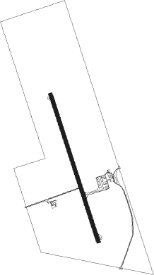
| Runway 17 / 35 | ||
| length | 1816m (5958ft) | |
| bearing | 166° / 346° | |
| width | 45m (148ft) | |
| surface | asphalt | |
Nearby beacons
| code | identifier | dist | bearing | frequency |
|---|---|---|---|---|
| GJM | GUAJARA-MIRIM (GUAJARA MIRIM) NDB | 0.2 | 7° | 400 |
| GMI | GUAJARA NDB | 3.3 | 281° | 335 |
| GYA | GUAYARAMERIN NDB | 4.2 | 239° | 250 |
Departure and arrival routes
| Transition altitude | 3000ft |
| SID end points | distance | outbound heading | |
|---|---|---|---|
| RW17 | |||
| ANSA1A | 105mi | 129° | |
| RW35 | |||
| ANDU1A | 105mi | 129° | |
Instrument approach procedures
| runway | airway (heading) | route (dist, bearing) |
|---|---|---|
| RW17 | GM006 (187°) | GM006 3000ft GM004 (5mi, 237°) 2100ft |
| RW17 | GM007 (166°) | GM007 3000ft GM004 (5mi, 166°) 2100ft |
| RNAV | GM004 2100ft ANDUB (5mi, 166°) 2100ft GM013 (3mi, 166°) 1200ft SBGM (3mi, 163°) 504ft (3949mi, 81°) 2500ft GM006 (3946mi, 261°) 3000ft GM006 (turn) 3000ft | |
| RW35 | GM002 (347°) | GM002 3000ft GM001 (5mi, 346°) 2200ft |
| RW35 | GM003 (325°) | GM003 3000ft GM001 (5mi, 276°) 2200ft |
| RNAV | GM001 2200ft ANSAG (5mi, 346°) 2110ft GM014 (3mi, 346°) 1200ft SBGM (3mi, 350°) 518ft (3949mi, 81°) 2500ft GM003 (3942mi, 260°) 3000ft GM003 (turn) 3000ft |
Disclaimer
The information on this website is not for real aviation. Use this data with the X-Plane flight simulator only! Data taken with kind consent from X-Plane 12 source code and data files. Content is subject to change without notice.