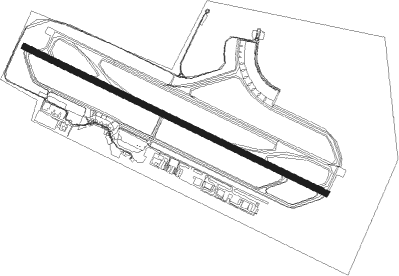
Goiânia - Santa Genoveva
Airport details
| Country | Brazil |
| State | Goiás |
| Region | SB |
| Airspace | Brasilia Ctr |
| Municipality | Goiânia |
| Elevation | 2450ft (747m) |
| Timezone | GMT -3 |
| Coordinates | -16.62972, -49.22667 |
| Magnetic var | |
| Type | land |
| Available since | X-Plane v10.40 |
| ICAO code | SBGO |
| IATA code | GYN |
| FAA code | n/a |
Communication
| Santa Genoveva ATIS | 127.675 |
| Santa Genoveva Ground Control | 121.700 |
| Santa Genoveva GOIANIA Tower | 121.050 |
| Santa Genoveva GOIANIA Tower | 118.700 |
Nearby Points of Interest:
Praça Cívica
-Parish Church of Our Lady of the Rosary
-House of the Babilónia Estate
Nearby beacons
| code | identifier | dist | bearing | frequency |
|---|---|---|---|---|
| GNV | GOIANIA VOR/DME | 1.1 | 126° | 115.90 |
| APO | ANAPOLIS VOR/DME | 27.1 | 33° | 116.80 |
| SBG | SANTA BARBARA (ANAPOLIS) NDB | 27.3 | 276° | 230 |
Departure and arrival routes
| Transition altitude | 7000ft |
| SID end points | distance | outbound heading | |
|---|---|---|---|
| RW14 | |||
| OMNI | 38mi | 35° | |
| LODU2B | 28mi | 59° | |
| DALS1A | 26mi | 78° | |
| SATN1A, SATN2B | 28mi | 139° | |
| SEKL2B | 41mi | 168° | |
| SELM2B | 41mi | 179° | |
| DALO1A, UBSU2B | 40mi | 233° | |
| GNV2B | 39mi | 277° | |
| OPLI2B | 77mi | 333° | |
| RW32 | |||
| OMNI | 38mi | 35° | |
| LODU1C, LODU1A | 28mi | 59° | |
| GNV1C | 41mi | 179° | |
| DETI1A, UBSU1C | 40mi | 233° | |
| EGAT1A, TENE1C | 39mi | 277° | |
| NIMV1C | 39mi | 284° | |
| OPLI1C | 77mi | 333° | |
Instrument approach procedures
| runway | airway (heading) | route (dist, bearing) |
|---|---|---|
| RW14-X | GO023 (228°) | GO023 7000ft GO024 (5mi, 299°) 6000ft GO026 (5mi, 255°) 4500ft GO019 (3mi, 188°) 3700ft |
| RNAV | GO019 3700ft GO016 (2mi, 142°) 3490ft SBGO (3mi, 120°) 2497ft GO008 (16mi, 119°) 6000ft GO008 (turn) 6000ft | |
| RW14 | GO002 (120°) | GO002 7000ft GO004 (5mi, 119°) 5500ft |
| RW14 | GO021 (90°) | GO021 7000ft GO004 (6mi, 31°) 5500ft |
| RW14 | GO034 (150°) | GO034 7000ft GO004 (6mi, 211°) 5500ft |
| RNAV | GO004 5500ft GO006 (5mi, 119°) 4130ft GO033 (3mi, 119°) 3133ft SBGO (2mi, 120°) 2497ft (3079mi, 71°) 4000ft GO021 (3090mi, 251°) 7000ft GO021 (turn) 7000ft | |
| RW32 | GO008 (299°) | GO008 7000ft GO011 (5mi, 299°) 5500ft |
| RW32 | GO029 (271°) | GO029 7000ft GO011 (6mi, 211°) 5500ft |
| RW32 | GO032 (328°) | GO032 7000ft GO011 (6mi, 31°) 5500ft |
| RNAV | GO011 5500ft GO012 (5mi, 299°) 4100ft GO020 (3mi, 299°) 3140ft SBGO (3mi, 298°) 2503ft (3079mi, 71°) 4800ft GO032 (3075mi, 251°) 7000ft GO032 (turn) 7000ft |
Disclaimer
The information on this website is not for real aviation. Use this data with the X-Plane flight simulator only! Data taken with kind consent from X-Plane 12 source code and data files. Content is subject to change without notice.