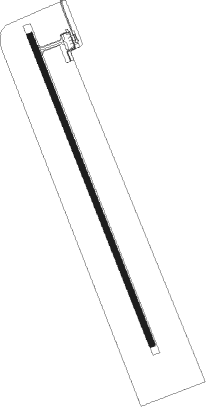
Itumbiara - Hidroeletrica
Airport details
| Country | Brazil |
| State | Goiás |
| Region | SB |
| Airspace | Brasilia Ctr |
| Municipality | Itumbiara |
| Elevation | 1628ft (496m) |
| Timezone | GMT -3 |
| Coordinates | -18.44500, -49.21417 |
| Magnetic var | |
| Type | land |
| Available since | X-Plane v10.40 |
| ICAO code | SBIT |
| IATA code | ITR |
| FAA code | n/a |
Communication
| Hidroeletrica RDO | 130.300 |
Runway info
| Runway 18 / 36 | ||
| length | 1759m (5771ft) | |
| bearing | 162° / 342° | |
| width | 31m (102ft) | |
| surface | asphalt | |
| blast zone | 60m (197ft) / 60m (197ft) | |
Nearby beacons
| code | identifier | dist | bearing | frequency |
|---|---|---|---|---|
| CAL | NOVAS DME | 55.1 | 40° | 113.20 |
| CAL | CALDAS NOVAS NDB | 55.3 | 40° | 290 |
| ULD | UBERLANDIA NDB | 61.9 | 114° | 350 |
| ULD | UBERLANDIA VOR/DME | 62.1 | 113° | 116.10 |
Departure and arrival routes
| Transition altitude | 4000ft |
| SID end points | distance | outbound heading | |
|---|---|---|---|
| RW18 | |||
| OMNI | 62mi | 110° | |
| RW36 | |||
| OMNI | 62mi | 110° | |
Instrument approach procedures
| runway | airway (heading) | route (dist, bearing) |
|---|---|---|
| RW18-Y | IT016 (132°) | IT016 5000ft IT014 (6mi, 74°) 3600ft |
| RW18-Y | IT017 (162°) | IT017 5000ft IT014 (5mi, 162°) 3600ft |
| RW18-Y | IT018 (193°) | IT018 5000ft IT014 (6mi, 254°) 3600ft |
| RNAV | IT014 3600ft IT013 (5mi, 162°) 3270ft IT019 (3mi, 162°) 2313ft SBIT (8147mi, 91°) 1676ft (8417mi, 279°) 2400ft IT016 (3112mi, 250°) 5000ft IT016 (turn) 5000ft | |
| RW36-Z | IT004 (313°) | IT004 5000ft IT003 (6mi, 254°) 3500ft |
| RW36-Z | IT006 (12°) | IT006 5000ft IT003 (6mi, 74°) 3500ft |
| RW36-Z | IT007 (342°) | IT007 5000ft IT003 (5mi, 342°) 3500ft |
| RNAV | IT003 3500ft IT002 (5mi, 342°) 3430ft IT011 (3mi, 342°) 2470ft IT001 (2mi, 342°) 1833ft (3105mi, 69°) 2200ft IT006 (3111mi, 249°) 5000ft IT006 (turn) 5000ft |
Disclaimer
The information on this website is not for real aviation. Use this data with the X-Plane flight simulator only! Data taken with kind consent from X-Plane 12 source code and data files. Content is subject to change without notice.
