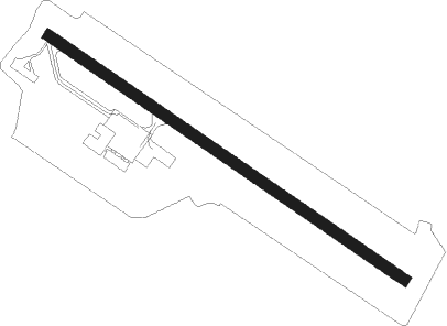
Joinville - Lauro Carneiro De Loyola
Airport details
| Country | Brazil |
| State | Santa Catarina |
| Region | SB |
| Airspace | Curitiba Ctr |
| Municipality | Joinville |
| Elevation | 15ft (5m) |
| Timezone | GMT -3 |
| Coordinates | -26.22305, -48.79750 |
| Magnetic var | |
| Type | land |
| Available since | X-Plane v10.40 |
| ICAO code | SBJV |
| IATA code | JOI |
| FAA code | n/a |
Communication
| LAURO CARNEIRO DE LOYOLA Tower | 118.000 |
| LAURO CARNEIRO DE LOYOLA Tower | 120.500 |
Approach frequencies
| ILS-cat-I | RW33 | 111.1 | 18.00mi |
| 3° GS | RW33 | 111.1 | 18.00mi |
Nearby beacons
| code | identifier | dist | bearing | frequency |
|---|---|---|---|---|
| JNV | JOINVILLE VOR/DME | 0 | 325° | 115.10 |
| PGA | DME | 43.6 | 21° | 114.10 |
| CTB | CURITIBA VOR/DME | 46 | 332° | 116.50 |
| BCH | BACACHERI NDB | 54.5 | 332° | 300 |
| LAA | DME | 58.5 | 295° | 117.70 |
Departure and arrival routes
| Transition altitude | 6000ft |
| SID end points | distance | outbound heading | |
|---|---|---|---|
| RW15 | |||
| AKSE1E | 85mi | 50° | |
| UMDU1E | 33mi | 199° | |
| OGPO1A | 88mi | 354° | |
| RW33 | |||
| OPTE1F | 85mi | 50° | |
| POXO1F | 33mi | 199° | |
| PAGE1A | 88mi | 354° | |
| STAR starting points | distance | inbound heading | |
|---|---|---|---|
| RW15 | |||
| TOSE1E | 101.7 | 13° | |
| IVTA1E | 64.5 | 137° | |
| CTB1E | 46.0 | 152° | |
| RAXI1E | 123.7 | 212° | |
| RW33 | |||
| TOSE1F | 101.7 | 13° | |
| IVTA1F | 64.5 | 137° | |
| RAXI1F | 123.7 | 212° | |
Instrument approach procedures
| runway | airway (heading) | route (dist, bearing) |
|---|---|---|
| RW15-X | JV402 (195°) | JV402 6000ft JV301 (14mi, 211°) 2400ft |
| RNAV | JV301 2400ft JV302 (5mi, 197°) 1720ft JV303 (3mi, 160°) 793ft JV304 (2mi, 126°) 65ft JV306 (5mi, 126°) JV401 (8mi, 71°) JV017 (4mi, 12°) 5000ft JV017 (turn) 5000ft | |
| RW15-Y | JV402 (195°) | JV402 6000ft JV086 (8mi, 211°) 3900ft JV301 (6mi, 211°) 2400ft |
| RNAV | JV301 2400ft JV302 (5mi, 197°) 1730ft JV303 (3mi, 160°) 794ft SBJV (3mi, 125°) 65ft JV087 (6mi, 126°) JV088 (7mi, 71°) JV017 (6mi, 11°) 5000ft JV017 (turn) 5000ft | |
| RW15-Z | ANDAM (198°) | ANDAM 6000ft JV012 (6mi, 213°) 5000ft JV011 (15mi, 213°) 2100ft |
| RW15-Z | VULUD (177°) | VULUD 6000ft JV012 (6mi, 118°) 5000ft JV011 (15mi, 213°) 2100ft |
| RW15-Z | VUNBA (212°) | VUNBA 6000ft JV012 (6mi, 298°) 5000ft JV011 (15mi, 213°) 2100ft |
| RNAV | JV011 2100ft JV013 (4mi, 166°) 1500ft JV016 (3mi, 134°) 345ft JV033 (18mi, 126°) 3000ft JV033 (turn) 3000ft | |
| RW33-X | JV017 (254°) | JV017 4200ft JV316 (6mi, 228°) 2500ft |
| RNAV | JV316 2500ft JV019 (3mi, 228°) 2255ft JV318 (3mi, 267°) 1100ft SBJV (4mi, 307°) 60ft JV319 (turn) 500ft JV404 (8mi, 348°) JV402 (15mi, 32°) 6000ft JV402 (turn) 6000ft | |
| RW33-Y | JV017 (254°) | JV017 4200ft JV316 (6mi, 228°) 2500ft |
| RNAV | JV316 2500ft JV091 (3mi, 222°) 2450ft JV092 (4mi, 265°) 1206ft SBJV (4mi, 307°) 60ft JV094 (2mi, 305°) JV096 (7mi, 349°) JV402 (16mi, 34°) 6000ft JV402 (turn) 6000ft | |
| RW33-Z | ARNED (278°) | ARNED 4000ft JV036 (6mi, 222°) 2200ft |
| RW33-Z | KIMAD (337°) | KIMAD 4000ft JV036 (6mi, 42°) 2200ft |
| RNAV | JV036 2200ft UMDUK (5mi, 306°) 1650ft SBJV (6mi, 306°) 60ft (3230mi, 62°) 800ft GEPVO (3226mi, 242°) ARNED (18mi, 135°) 4000ft ARNED (turn) 4000ft |
Holding patterns
| STAR name | hold at | type | turn | heading* | altitude | leg | speed limit |
|---|---|---|---|---|---|---|---|
| CTB1E | ILSUV | VHF | left | 335 (155)° | 1.0min timed | ICAO rules | |
| IVTA1E | JV067 | VHF | right | 302 (122)° | 1.0min timed | ICAO rules | |
| IVTA1F | JV067 | VHF | right | 302 (122)° | 1.0min timed | ICAO rules | |
| RAXI1E | ANGOG | VHF | right | 67 (247)° | 1.0min timed | ICAO rules | |
| RAXI1F | ANGOG | VHF | right | 67 (247)° | 1.0min timed | ICAO rules | |
| *) magnetic outbound (inbound) holding course | |||||||
Disclaimer
The information on this website is not for real aviation. Use this data with the X-Plane flight simulator only! Data taken with kind consent from X-Plane 12 source code and data files. Content is subject to change without notice.
