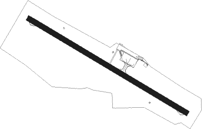
Campina Grande - Presidente Joao Suassuna
Airport details
| Country | Brazil |
| State | Paraíba |
| Region | SB |
| Airspace | Recife Ctr |
| Municipality | Campina Grande |
| Elevation | 1645ft (501m) |
| Timezone | GMT -3 |
| Coordinates | -7.26917, -35.89500 |
| Magnetic var | |
| Type | land |
| Available since | X-Plane v10.40 |
| ICAO code | SBKG |
| IATA code | CPV |
| FAA code | n/a |
Communication
| PRESIDENTE JOAO SUASSUNA AFIS | 125.500 |
| PRESIDENTE JOAO SUASSUNA CAMPINA GRANDE RDO | 125.900 |
Approach frequencies
| IGS | RW15 | 109.1 | 18.00mi |
| 3° GS | RW15 | 109.1 | 18.00mi |
Runway info
| Runway 15 / 33 | ||
| length | 1609m (5279ft) | |
| bearing | 125° / 305° | |
| width | 44m (144ft) | |
| surface | asphalt | |
| blast zone | 51m (167ft) / 61m (200ft) | |
Nearby beacons
| code | identifier | dist | bearing | frequency |
|---|---|---|---|---|
| CPG | CAMPINA GRANDE NDB | 0.2 | 36° | 230 |
| JPS | JOAO PESSOA NDB | 56.6 | 82° | 320 |
| JPS | PESSOA DME | 56.9 | 83° | 114 |
| VSA | DE SANTO ANTAO DME | 61.9 | 144° | 113.70 |
Departure and arrival routes
| Transition altitude | 5000ft |
| Transition level | 50ft |
| SID end points | distance | outbound heading | |
|---|---|---|---|
| RW15 | |||
| NTL1A | 90mi | 25° | |
| JPS1A, JPS1B | 57mi | 82° | |
| NEUM1A | 28mi | 197° | |
| VACA1A | 29mi | 215° | |
| OPSU1A | 102mi | 275° | |
| KODS1A | 121mi | 309° | |
| MSS1A | 152mi | 325° | |
| RW33 | |||
| NTL1A | 90mi | 25° | |
| JPS1B, JPS1A | 57mi | 82° | |
| NEUM1A | 28mi | 197° | |
| VACA1A | 29mi | 215° | |
| OPSU1A | 102mi | 275° | |
| KODS1A | 121mi | 309° | |
| MSS1A | 152mi | 325° | |
Instrument approach procedures
| runway | airway (heading) | route (dist, bearing) |
|---|---|---|
| RW15 | KG002 (125°) | KG002 5000ft KG004 (6mi, 125°) 3700ft |
| RW15 | KG016 (155°) | KG016 5000ft KG004 (6mi, 215°) 3700ft |
| RW15 | KG017 (95°) | KG017 5000ft KG004 (6mi, 35°) 3700ft |
| RNAV | KG004 3700ft KG006 (5mi, 125°) 3300ft KG010 (1mi, 125°) 2882ft SBKG (4mi, 124°) 1658ft KG007 (10mi, 125°) 5000ft KG007 (turn) 5000ft | |
| RW33 | KG009 (305°) | KG009 5000ft KG007 (6mi, 305°) 3500ft |
| RW33 | KG013 (275°) | KG013 5000ft KG007 (6mi, 215°) 3500ft |
| RW33 | KG014 (335°) | KG014 5000ft KG007 (6mi, 35°) 3500ft |
| RNAV | KG007 3500ft KG012 (5mi, 305°) 3290ft KG018 (3mi, 305°) 2396ft SBKG (3mi, 306°) 1696ft KG004 (10mi, 305°) 5000ft KG004 (turn) 5000ft |
Disclaimer
The information on this website is not for real aviation. Use this data with the X-Plane flight simulator only! Data taken with kind consent from X-Plane 12 source code and data files. Content is subject to change without notice.
