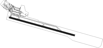
Londrina
Airport details
| Country | Brazil |
| State | Paraná |
| Region | SB |
| Airspace | Curitiba Ctr |
| Municipality | Londrina |
| Elevation | 1867ft (569m) |
| Timezone | GMT -3 |
| Coordinates | -23.33028, -51.13667 |
| Magnetic var | |
| Type | land |
| Available since | X-Plane v10.40 |
| ICAO code | SBLO |
| IATA code | LDB |
| FAA code | n/a |
Communication
| Londrina ATIS | 127.675 |
| Londrina Tower | 118.400 |
| Londrina Approach | 129.700 |
| Londrina Approach | 129.690 |
Nearby beacons
| code | identifier | dist | bearing | frequency |
|---|---|---|---|---|
| LON | LONDRINA VOR/DME | 1.4 | 111° | 112.40 |
| APC | APUCARANA NDB | 23.2 | 225° | 215 |
| TLB | TELAMACO (TELAMACO BORBA) NDB | 65 | 154° | 285 |
Departure and arrival routes
| Transition altitude | 5000ft |
| SID end points | distance | outbound heading | |
|---|---|---|---|
| RW13 | |||
| AKRA1A, AKRA1B | 41mi | 138° | |
| RW31 | |||
| AKTI1A | 41mi | 66° | |
| EDPU1A, UKDU1A | 41mi | 138° | |
| SIGA1A | 69mi | 234° | |
| KUDR1A | 82mi | 252° | |
| PAMU1A | 44mi | 309° | |
| KOTE1A | 39mi | 347° | |
Instrument approach procedures
| runway | airway (heading) | route (dist, bearing) |
|---|---|---|
| RW13-X | LO206 (1°) | LO206 5000ft LO207 (6mi, 310°) 4000ft |
| RNAV | LO207 4000ft LO208 (4mi, 360°) 3510ft LO204 (3mi, 80°) 2553ft LO107 (2mi, 109°) 1917ft LO108 (16mi, 108°) 5000ft LO108 (turn) 5000ft | |
| RW13-Y | LO201 (232°) | LO201 5000ft LO202 (6mi, 281°) 4000ft |
| RNAV | LO202 4000ft LO203 (5mi, 230°) 3510ft LO204 (3mi, 139°) 2553ft LO107 (2mi, 109°) 1917ft LO108 (16mi, 108°) 5000ft LO108 (turn) 5000ft | |
| RW13-Z | LO134 (133°) | LO134 5000ft LO133 (6mi, 180°) 4000ft |
| RW13-Z | LO136 (108°) | LO136 5000ft LO133 (5mi, 109°) 4000ft |
| RW13-Z | LO137 (85°) | LO137 5000ft LO133 (6mi, 42°) 4000ft |
| RNAV | LO133 4000ft LO132 (5mi, 109°) 3510ft LO138 (3mi, 109°) 2580ft SBLO (2mi, 107°) 1916ft LO314 (16mi, 109°) 5000ft LO314 (turn) 5000ft | |
| RW31-Y | LO221 (282°) | LO221 5000ft LO312 (6mi, 269°) 4000ft |
| RW31-Y | LO222 (302°) | LO222 5000ft LO312 (6mi, 328°) 4000ft |
| RNAV | LO312 4000ft LO311 (5mi, 289°) 3460ft SBLO (6mi, 289°) 1862ft LO136 (15mi, 288°) 5000ft LO136 (turn) 5000ft | |
| RW31-Z | LO313 (317°) | LO313 5000ft LO312 (6mi, 21°) 4000ft |
| RW31-Z | LO314 (289°) | LO314 5000ft LO312 (5mi, 288°) 4000ft |
| RW31-Z | LO316 (262°) | LO316 5000ft LO312 (6mi, 201°) 4000ft |
| RNAV | LO312 4000ft LO311 (5mi, 289°) 3460ft LO320 (3mi, 289°) 2530ft SBLO (3mi, 290°) 1862ft LO136 (15mi, 288°) 5000ft LO136 (turn) 5000ft |
Disclaimer
The information on this website is not for real aviation. Use this data with the X-Plane flight simulator only! Data taken with kind consent from X-Plane 12 source code and data files. Content is subject to change without notice.
