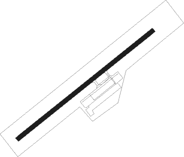
Navegantes - Ministro Victor Konder
Airport details
| Country | Brazil |
| State | Santa Catarina |
| Region | SB |
| Airspace | Curitiba Ctr |
| Municipality | Navegantes |
| Elevation | 18ft (5m) |
| Timezone | GMT -3 |
| Coordinates | -26.87861, -48.65083 |
| Magnetic var | |
| Type | land |
| Available since | X-Plane v10.40 |
| ICAO code | SBNF |
| IATA code | NVT |
| FAA code | n/a |
Communication
| Ministro Victor Konder ATIS | 127.625 |
| Ministro Victor Konder NAVEGANTES Tower | 118.200 |
| Ministro Victor Konder NAVEGANTES Approach | 119.500 |
Nearby beacons
| code | identifier | dist | bearing | frequency |
|---|---|---|---|---|
| JNV | JOINVILLE VOR/DME | 40.2 | 347° | 115.10 |
| BIG | DME | 44.6 | 179° | 113.70 |
| FLN | FLORIANOPOLIS VOR/DME | 47.8 | 172° | 113.40 |
Departure and arrival routes
| Transition altitude | 6000ft |
| SID end points | distance | outbound heading | |
|---|---|---|---|
| RW07 | |||
| EDPO1C | 51mi | 53° | |
| ILNU1C | 25mi | 190° | |
| ARSI1C | 74mi | 229° | |
| KETU1C | 87mi | 248° | |
| OMNI | 61mi | 313° | |
| ILVO1C | 46mi | 352° | |
| RW25 | |||
| VUBU1D | 66mi | 50° | |
| BUVR1D | 87mi | 248° | |
| OMNI | 61mi | 313° | |
| ILVO1D | 46mi | 352° | |
| STAR starting points | distance | inbound heading | |
|---|---|---|---|
| RW07 | |||
| NIBS1C | 33.1 | 52° | |
| EDRE1C | 78.7 | 152° | |
| PUBI1C | 60.7 | 216° | |
| EVPI1C | 12.0 | 266° | |
| RW25 | |||
| ALDO1D | 26.1 | 77° | |
| EDRE1D | 78.7 | 152° | |
| PUBI1D | 60.7 | 216° | |
| EVPI1D | 12.0 | 266° | |
Instrument approach procedures
| runway | airway (heading) | route (dist, bearing) |
|---|---|---|
| RW07-X | NF006 (319°) | NF006 4000ft NF118 (6mi, 258°) 2000ft |
| RNAV | NF118 2000ft NF119 (4mi, 307°) 1980ft NF106 (2mi, 33°) 1259ft SBNF (4mi, 58°) 68ft NF013 (15mi, 59°) 4000ft NF013 (turn) 4000ft | |
| RW07-Y | NF102 (132°) | NF102 4000ft NF103 (6mi, 194°) 2400ft |
| RNAV | NF103 2400ft NF104 (3mi, 147°) 1980ft NF106 (2mi, 83°) 1259ft SBNF (4mi, 58°) 68ft NF013 (15mi, 59°) 4000ft NF013 (turn) 4000ft | |
| RW07-Z | BUTMU (28°) | BUTMU 4000ft NF027 (6mi, 323°) 2700ft |
| RW07-Z | EGUXU (86°) | EGUXU 4000ft NF027 (6mi, 143°) 2700ft |
| RW07-Z | ESNEM (59°) | ESNEM 5000ft NF027 (5mi, 59°) 2700ft |
| RNAV | NF027 2700ft NF171 (3mi, 59°) 1900ft NF002 (2mi, 59°) 1660ft NF169 (2mi, 59°) 1023ft SBNF (3mi, 58°) 68ft (3237mi, 61°) 2000ft BUTMU (3246mi, 241°) 4000ft BUTMU (turn) 4000ft | |
| RW25-X | NF121 (256°) | NF121 4000ft NF122 (6mi, 263°) 2100ft |
| RNAV | NF122 2100ft NF123 (4mi, 263°) 2010ft NF112 (2mi, 251°) 1296ft SBNF (4mi, 239°) 67ft NF106 (4mi, 238°) NF124 (10mi, 135°) NF121 (19mi, 44°) 4000ft NF121 (turn) 4000ft | |
| RW25-Y | NF108 (205°) | NF108 4000ft NF109 (6mi, 188°) 2000ft |
| RNAV | NF109 2000ft NF111 (4mi, 188°) 1980ft NF112 (2mi, 214°) 1296ft SBNF (4mi, 239°) 67ft NF106 (4mi, 238°) NF124 (10mi, 135°) NF121 (19mi, 44°) 4000ft NF121 (turn) 4000ft | |
| RW25-Z | DOVRO (209°) | DOVRO 4000ft NF019 (6mi, 143°) 2500ft |
| RW25-Z | EGBID (266°) | EGBID 4000ft NF019 (6mi, 323°) 2500ft |
| RNAV | NF019 2500ft NF021 (4mi, 239°) 2050ft NF172 (3mi, 239°) 1021ft NF173 (1mi, 239°) 726ft SBNF (2mi, 239°) 67ft (3237mi, 61°) 2000ft EGBID (3225mi, 241°) 4000ft EGBID (turn) 4000ft |
Holding patterns
| STAR name | hold at | type | turn | heading* | altitude | leg | speed limit |
|---|---|---|---|---|---|---|---|
| EDRE1C | PONLU | VHF | left | 5 (185)° | 1.0min timed | ICAO rules | |
| EDRE1D | PONLU | VHF | left | 5 (185)° | 1.0min timed | ICAO rules | |
| EVPI1C | NF012 | VHF | left | 101 (281)° | 1.0min timed | ICAO rules | |
| EVPI1D | NF012 | VHF | left | 101 (281)° | 1.0min timed | ICAO rules | |
| NIBS1C | NIBSI | VHF | left | 242 (62)° | 1.0min timed | ICAO rules | |
| PUBI1C | NF168 | VHF | left | 73 (253)° | 1.0min timed | ICAO rules | |
| PUBI1D | NF168 | VHF | left | 73 (253)° | 1.0min timed | ICAO rules | |
| *) magnetic outbound (inbound) holding course | |||||||
Disclaimer
The information on this website is not for real aviation. Use this data with the X-Plane flight simulator only! Data taken with kind consent from X-Plane 12 source code and data files. Content is subject to change without notice.
