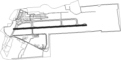
Porto Alegre - Salgado Filho
Airport details
| Country | Brazil |
| State | Rio Grande do Sul |
| Region | SB |
| Airspace | Curitiba Ctr |
| Municipality | Porto Alegre |
| Elevation | 11ft (3m) |
| Timezone | GMT -3 |
| Coordinates | -29.99472, -51.17111 |
| Magnetic var | |
| Type | land |
| Available since | X-Plane v10.40 |
| ICAO code | SBPA |
| IATA code | POA |
| FAA code | n/a |
Communication
| Salgado Filho ATIS | 132.350 |
| Salgado Filho Ground Control | 121.900 |
| Salgado Filho PALEGRE Tower | 118.100 |
| Salgado Filho PALEGRE Approach | 120.100 |
| Salgado Filho PALEGRE Approach | 120.550 |
| Salgado Filho PALEGRE Approach | 128.900 |
| Salgado Filho PALEGRE Approach | 119.000 |
| Salgado Filho PALEGRE ACC | 122.150 |
Approach frequencies
| ILS-cat-I | RW11 | 110.3 | 18.00mi |
| 3° GS | RW11 | 110.3 | 18.00mi |
Nearby Points of Interest:
Palácio do Vice Governador
-Palacete Argentina
-Faculdade de Direito da Universidade Federal do Rio Grande do Sul
-Prédio Força e Luz
-Biblioteca Pública
-Antigo Palácio do Governo (Forte Apache)
-Praça Marechal Deodoro
-Arquivo Público
-Antiga Provedoria da Real Fazenda
-Solar dos Câmara
-Farroupilha Museum
Nearby beacons
| code | identifier | dist | bearing | frequency |
|---|---|---|---|---|
| POR | PORTO ALEGRE VOR/DME | 0.3 | 101° | 114 |
| PAG | PORTO ALEGRE NDB | 0.4 | 236° | 330 |
| COA | CANOAS (PORTO ALEGRE) VOR/DME | 2.9 | 29° | 113.60 |
| FIG | FIGUEIRAS (PORTO ALEGRE) VOR/DME | 10.1 | 91° | 114.70 |
| TQA | DME | 28.1 | 50° | 112.90 |
| TQI | DME | 36.4 | 287° | 114.50 |
| CXS | DO SUL VOR/DME | 47.8 | 359° | 112.30 |
Departure and arrival routes
| Transition altitude | 4000ft |
| SID end points | distance | outbound heading | |
|---|---|---|---|
| RW11 | |||
| NIRT1A | 118mi | 10° | |
| JUIC1A | 152mi | 51° | |
| ESNU2A | 95mi | 247° | |
| IMPE1A | 94mi | 276° | |
| PUKS1A | 55mi | 344° | |
| RW29 | |||
| VASE2B | 118mi | 10° | |
| PUDM1B, TISG1B | 152mi | 51° | |
| EGBA1B | 95mi | 247° | |
| SUSK2B | 55mi | 282° | |
| STAR starting points | distance | inbound heading | |
|---|---|---|---|
| RW11 | |||
| ARPE1A | 47.4 | 58° | |
| DOPG1A | 55.5 | 96° | |
| BUXE3A | 24.0 | 155° | |
| TIMV3A | 96.6 | 231° | |
| RW29 | |||
| DAKA1B | 13.8 | 70° | |
| UBRE1B | 28.3 | 239° | |
Instrument approach procedures
| runway | airway (heading) | route (dist, bearing) |
|---|---|---|
| RW11-Z | DAKAT (70°) | DAKAT 4000ft PA004 (6mi, 24°) 2700ft |
| RW11-Z | GEMGI (91°) | GEMGI 4000ft PA004 (5mi, 91°) 2700ft |
| RW11-Z | OGVUV (112°) | OGVUV 4000ft PA004 (6mi, 159°) 2700ft |
| RNAV | PA004 2700ft ISEPA (5mi, 91°) 1720ft POA01 (3mi, 91°) 600ft SBPA (3mi, 91°) 61ft (3430mi, 60°) 3000ft VUGET (3423mi, 239°) VUGET (turn) | |
| RW29-Y | KOTUB (250°) | KOTUB 4000ft PA024 (6mi, 204°) 2300ft |
| RW29-Y | PA006 (271°) | PA006 4000ft PA024 (5mi, 271°) 2300ft |
| RW29-Y | VUGBO (292°) | VUGBO 4000ft PA024 (6mi, 339°) 2300ft |
| RNAV | PA024 2300ft NETPI (5mi, 271°) 1650ft POA05 (3mi, 271°) 790ft SBPA (3mi, 271°) 61ft (3430mi, 60°) 3000ft DAKAT (3444mi, 240°) 4000ft DAKAT (turn) 4000ft |
Holding patterns
| STAR name | hold at | type | turn | heading* | altitude | leg | speed limit |
|---|---|---|---|---|---|---|---|
| ARPE1A | SELRI | VHF | right | 246 (66)° | 1.0min timed | ICAO rules | |
| BUXE3A | BUXEV | VHF | right | 35 (215)° | 1.0min timed | ICAO rules | |
| DAKA1B | DAKAT | VHF | right | 288 (108)° | 1.0min timed | ICAO rules | |
| TIMV3A | VUGBO | VHF | left | 108 (288)° | 1.0min timed | ICAO rules | |
| UBRE1B | UBREG | VHF | left | 60 (240)° | 1.0min timed | ICAO rules | |
| *) magnetic outbound (inbound) holding course | |||||||
Disclaimer
The information on this website is not for real aviation. Use this data with the X-Plane flight simulator only! Data taken with kind consent from X-Plane 12 source code and data files. Content is subject to change without notice.