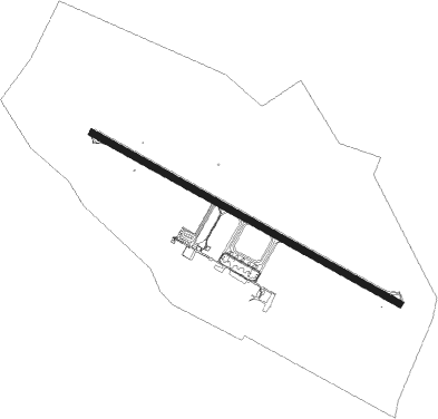
Palmas - Palmas Airport
Airport details
| Country | Brazil |
| State | Tocantins |
| Region | SB |
| Airspace | Brasilia Ctr |
| Municipality | Palmas |
| Elevation | 772ft (235m) |
| Timezone | GMT -3 |
| Coordinates | -10.29000, -48.35778 |
| Magnetic var | |
| Type | land |
| Available since | X-Plane v10.40 |
| ICAO code | SBPJ |
| IATA code | PMW |
| FAA code | n/a |
Communication
| Palmas Airport PALMAS RDO | 119.000 |
| Palmas Airport PALMAS Tower | 118.000 |
| Palmas Airport PALMAS Approach | 119.000 |
Nearby beacons
| code | identifier | dist | bearing | frequency |
|---|---|---|---|---|
| PMS | PALMAS VOR/DME | 0.1 | 339° | 112.20 |
| PNC | PORTO NACIONAL VOR/DME | 25.8 | 186° | 113 |
Departure and arrival routes
| Transition altitude | 4000ft |
| Transition level | 40ft |
| SID end points | distance | outbound heading | |
|---|---|---|---|
| RW14 | |||
| DORS1A | 40mi | 334° | |
| OMNI | 268mi | 340° | |
| RW32 | |||
| GEDE1A | 40mi | 334° | |
| OMNI | 268mi | 340° | |
| STAR starting points | distance | inbound heading | |
|---|---|---|---|
| RW14 | |||
| ANPU2A | 40.5 | 24° | |
| ISOB2A | 40.2 | 154° | |
| ILNO1A | 99.3 | 179° | |
| OPLO2A | 88.9 | 209° | |
| RW32 | |||
| ISOB2B | 75.6 | 153° | |
| OBGO2A | 39.8 | 212° | |
| LIBE2A | 60.2 | 357° | |
Instrument approach procedures
| runway | airway (heading) | route (dist, bearing) |
|---|---|---|
| RW14-Z | PJ012 (99°) | PJ012 4000ft PJ008 (6mi, 54°) 3500ft |
| RW14-Z | PJ014 (123°) | PJ014 4000ft PJ008 (6mi, 123°) 3500ft |
| RW14-Z | PJ017 (147°) | PJ017 4000ft PJ008 (6mi, 194°) 3500ft |
| RNAV | PJ008 3500ft PJ009 (5mi, 123°) 2370ft SBPJ (6mi, 123°) 775ft (2953mi, 78°) 1500ft NUXOL (2940mi, 258°) 4000ft NUXOL (turn) 4000ft | |
| RW32-Y | PJ022 (280°) | PJ022 4000ft PJ027 (6mi, 234°) 3500ft |
| RW32-Y | PJ026 (327°) | PJ026 4000ft PJ027 (6mi, 14°) 3500ft |
| RW32-Y | PJ029 (303°) | PJ029 4000ft PJ027 (6mi, 303°) 3500ft |
| RNAV | PJ027 3500ft PJ028 (5mi, 303°) 2420ft PMS13 (3mi, 303°) 1620ft SBPJ (3mi, 304°) 824ft (2953mi, 78°) 1500ft LOBIG (2959mi, 258°) 4000ft LOBIG (turn) 4000ft |
Holding patterns
| STAR name | hold at | type | turn | heading* | altitude | leg | speed limit |
|---|---|---|---|---|---|---|---|
| ANPU2A | PJ012 | VHF | right | 255 (75)° | 1.0min timed | ICAO rules | |
| ILNO1A | PJ017 | VHF | right | 35 (215)° | 1.0min timed | ICAO rules | |
| ISOB2A | PJ014 | VHF | right | 325 (145)° | 1.0min timed | ICAO rules | |
| ISOB2B | PJ022 | VHF | left | 75 (255)° | 1.0min timed | ICAO rules | |
| LIBE2A | PJ026 | VHF | left | 215 (35)° | 1.0min timed | ICAO rules | |
| OBGO2A | PJ022 | VHF | left | 75 (255)° | 1.0min timed | ICAO rules | |
| OPLO2A | PJ017 | VHF | right | 35 (215)° | 1.0min timed | ICAO rules | |
| *) magnetic outbound (inbound) holding course | |||||||
Disclaimer
The information on this website is not for real aviation. Use this data with the X-Plane flight simulator only! Data taken with kind consent from X-Plane 12 source code and data files. Content is subject to change without notice.