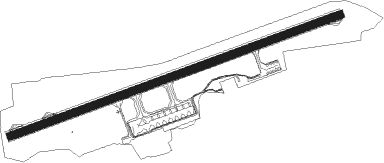
Porto Seguro
Airport details
| Country | Brazil |
| State | Bahia |
| Region | SB |
| Airspace | Recife Ctr |
| Municipality | Porto Seguro |
| Elevation | 166ft (51m) |
| Timezone | GMT -3 |
| Coordinates | -16.43806, -39.08389 |
| Magnetic var | |
| Type | land |
| Available since | X-Plane v10.40 |
| ICAO code | SBPS |
| IATA code | BPS |
| FAA code | n/a |
Communication
| Porto Seguro Tower 2 | 121.500 |
| Porto Seguro Tower | 118.850 |
Nearby Points of Interest:
Cidade Alta de Porto Seguro
-Discovery Coast Atlantic Forest Reserves
Nearby beacons
| code | identifier | dist | bearing | frequency |
|---|---|---|---|---|
| SGR | PORTO SEGURO NDB | 0.2 | 159° | 385 |
Departure and arrival routes
| Transition altitude | 4000ft |
| SID end points | distance | outbound heading | |
|---|---|---|---|
| RW10 | |||
| DIBU1A | 49mi | 14° | |
| LOBE1A | 40mi | 209° | |
| IRIN1A | 40mi | 266° | |
| MULA1C, MULA1A | 52mi | 341° | |
| RW28 | |||
| BUTN1A | 49mi | 14° | |
| DIBE1A | 40mi | 209° | |
| ULVO1A | 40mi | 266° | |
| MUKO1A | 40mi | 282° | |
| MULA1B | 52mi | 341° | |
| STAR starting points | distance | inbound heading | |
|---|---|---|---|
| RW10 | |||
| AMEN1A | 40.1 | 54° | |
| RAIR1A | 48.5 | 179° | |
Instrument approach procedures
| runway | airway (heading) | route (dist, bearing) |
|---|---|---|
| RW10-Z | PS022 (98°) | PS022 3000ft PS019 (6mi, 143°) 2000ft |
| RW10-Z | PS024 (75°) | PS024 4000ft PS019 (6mi, 75°) 2000ft |
| RW10-Z | PS026 (51°) | PS026 3000ft PS019 (6mi, 5°) 2000ft |
| RNAV | PS019 2000ft PS021 (5mi, 75°) 1820ft PS023 (2mi, 75°) 1010ft SBPS (3mi, 73°) 219ft (2515mi, 67°) 2000ft PS022 (2527mi, 247°) 3000ft PS022 (turn) 3000ft | |
| RW28-Y | PS031 (232°) | PS031 4000ft PS027 (6mi, 184°) 2500ft |
| RW28-Y | PS032 (278°) | PS032 4000ft PS027 (6mi, 323°) 2500ft |
| RW28-Y | PS033 (255°) | PS033 4000ft PS027 (6mi, 255°) 2500ft |
| RNAV | PS027 2500ft PS028 (5mi, 255°) 1860ft SBPS (6mi, 256°) 206ft (2515mi, 67°) 1200ft PS031 (2502mi, 247°) 4000ft PS031 (turn) 4000ft |
Holding patterns
| STAR name | hold at | type | turn | heading* | altitude | leg | speed limit |
|---|---|---|---|---|---|---|---|
| AMEN1A | PS034 | VHF | left | 254 (74)° | 1.0min timed | ICAO rules | |
| *) magnetic outbound (inbound) holding course | |||||||
Disclaimer
The information on this website is not for real aviation. Use this data with the X-Plane flight simulator only! Data taken with kind consent from X-Plane 12 source code and data files. Content is subject to change without notice.