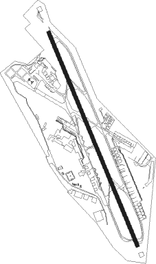
Recife - Recife Intl
Airport details
| Country | Brazil |
| State | Pernambuco |
| Region | SB |
| Airspace | Recife Ctr |
| Municipality | Recife |
| Elevation | 33ft (10m) |
| Timezone | GMT -3 |
| Coordinates | -8.12639, -34.92278 |
| Magnetic var | |
| Type | land |
| Available since | X-Plane v10.40 |
| ICAO code | SBRF |
| IATA code | REC |
| FAA code | n/a |
Communication
| Recife Intl RECIFE Ground Control | 121.850 |
| Recife Intl RECIFE Tower | 118.350 |
| Recife Intl RECIFE CTR | 125.350 |
| Recife Intl RECIFE Approach | 119.500 |
| Recife Intl RECIFE Departure | 119.500 |
Approach frequencies
| ILS-cat-I | RW18 | 110.3 | 18.00mi |
| 3° GS | RW18 | 110.3 | 18.00mi |
Nearby Points of Interest:
Hospital Pedro II
-Mercado de São José
-Rua da Aurora
-Academia Pernambucana de Letras
-Basilica and Monastery of St. Benedict, Olinda
-Olinda Cathedral
Nearby beacons
| code | identifier | dist | bearing | frequency |
|---|---|---|---|---|
| REC | RECIFE VOR/DME | 0.6 | 204° | 116.90 |
| IF | IBURA (RECIFE) NDB | 0.9 | 326° | 220 |
| YGA | DME | 16.9 | 6° | 112.90 |
| VSA | DE SANTO ANTAO DME | 21.7 | 273° | 113.70 |
| JPS | PESSOA DME | 58.8 | 359° | 114 |
| JPS | JOAO PESSOA NDB | 59.2 | 358° | 320 |
Departure and arrival routes
| Transition altitude | 4000ft |
| SID end points | distance | outbound heading | |
|---|---|---|---|
| RW18 | |||
| TOSOM1 | 48mi | 31° | |
| DORB2B | 41mi | 237° | |
| REC1B | 41mi | 290° | |
| SATM2A | 54mi | 320° | |
| MOVLA1, ANDO1A | 74mi | 352° | |
| RW36 | |||
| TEDAT1 | 48mi | 31° | |
| LOLUK1 | 101mi | 200° | |
| REC1D | 41mi | 237° | |
| NEGA2D, ESMA1A | 41mi | 290° | |
| ANDO1B, AKTO1D | 74mi | 352° | |
| STAR starting points | distance | inbound heading | |
|---|---|---|---|
| RW18 | |||
| BUVA1A | 68.2 | 48° | |
| GENA1A | 23.9 | 138° | |
| VURA1A | 32.3 | 198° | |
| ESGU2A | 104.4 | 211° | |
| RW36 | |||
| BUVA1C | 68.2 | 48° | |
| GENA1B | 23.9 | 138° | |
Instrument approach procedures
| runway | airway (heading) | route (dist, bearing) |
|---|---|---|
| RW18 | ANDOX (162°) | ANDOX 3000ft RF008 (6mi, 162°) 1700ft |
| RW18 | RF009 (191°) | RF009 3000ft RF008 (6mi, 252°) 1700ft |
| RW18 | RF011 (133°) | RF011 3000ft RF008 (6mi, 72°) 1700ft |
| RNAV | RF008 1700ft AKTOP (5mi, 162°) 1670ft SBRF (6mi, 162°) 73ft (2146mi, 77°) 2000ft RF009 (2142mi, 257°) 3000ft RF009 (turn) | |
| RW36 | LOLUK (313°) | LOLUK 3500ft SATMA (6mi, 252°) 2000ft |
| RW36 | RF003 (11°) | RF003 3500ft SATMA (6mi, 72°) 2000ft |
| RW36 | RF004 (342°) | RF004 3500ft SATMA (6mi, 342°) 2000ft |
| RNAV | SATMA 2000ft RF001 (5mi, 342°) 1670ft SBRF (6mi, 342°) 82ft (2146mi, 77°) 2500ft LOLUK (2139mi, 257°) 3500ft LOLUK (turn) 3500ft |
Holding patterns
| STAR name | hold at | type | turn | heading* | altitude | leg | speed limit |
|---|---|---|---|---|---|---|---|
| BUVA1A | BUVAD | VHF | right | 251 (71)° | < 60000ft | 1.0min timed | ICAO rules |
| BUVA1C | BUVAD | VHF | right | 251 (71)° | < 60000ft | 1.0min timed | ICAO rules |
| ESGU2A | RF033 | VHF | right | 39 (219)° | < 60000ft | 1.0min timed | ICAO rules |
| ESGU2A | RF034 | VHF | left | 58 (238)° | < 60000ft | 1.0min timed | ICAO rules |
| GENA1A | GENAK | VHF | right | 346 (166)° | 1.0min timed | ICAO rules | |
| GENA1B | GENAK | VHF | right | 346 (166)° | 1.0min timed | ICAO rules | |
| VURA1A | RF034 | VHF | left | 58 (238)° | < 60000ft | 1.0min timed | ICAO rules |
| VURA1A | VURAM | VHF | left | 44 (224)° | < 60000ft | 1.0min timed | ICAO rules |
| *) magnetic outbound (inbound) holding course | |||||||
Disclaimer
The information on this website is not for real aviation. Use this data with the X-Plane flight simulator only! Data taken with kind consent from X-Plane 12 source code and data files. Content is subject to change without notice.