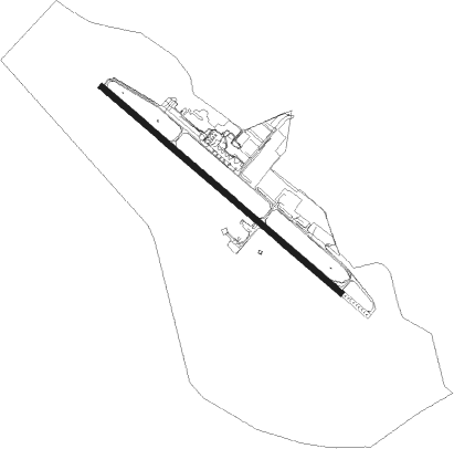
São José Dos Campos - Sao Jose Dos Campos
Airport details
| Country | Brazil |
| State | São Paulo |
| Region | SB |
| Airspace | Brasilia Ctr |
| Municipality | São José dos Campos |
| Elevation | 2120ft (646m) |
| Timezone | GMT -3 |
| Coordinates | -23.23136, -45.86279 |
| Magnetic var | |
| Type | land |
| Available since | X-Plane v10.40 |
| ICAO code | SBSJ |
| IATA code | SJK |
| FAA code | n/a |
Communication
| Sao Jose Dos Campos Ground Control | 121.900 |
| Sao Jose Dos Campos Tower | 118.500 |
| Sao Jose Dos Campos Approach | 119.250 |
| Sao Jose Dos Campos Approach | 129.050 |
Approach frequencies
| ILS-cat-I | RW16 | 110.3 | 18.00mi |
| 3° GS | RW16 | 110.3 | 18.00mi |
Nearby Points of Interest:
Casa do Ajudante Braga
-Pinacoteca de Mogi das Cruzes
-Palacete Palmeira
-Igreja de Nossa Senhora da Ajuda
-Site of the Candinha
-House of Sítio Mirim
Nearby beacons
| code | identifier | dist | bearing | frequency |
|---|---|---|---|---|
| SCP | SAO JOSE (SAO JOSE DOS CA VOR/DME | 0.1 | 123° | 115.40 |
| TBE | TAUBATE NDB | 22.1 | 62° | 430 |
| TAU | TAUBATE VOR/DME | 22.6 | 61° | 112.60 |
| BCO | BONSUCESSO (SAO PAULO) VOR/DME | 30.6 | 251° | 116 |
| PND | VIBASA (PINDAMONHANGABA) NDB | 34.9 | 55° | 205 |
| IG | TUCA (SAO PAULO) NDB | 41.5 | 252° | 410 |
| BGC | BRAGANCA (BRAGANCA PAULIS VOR/DME | 42.5 | 292° | 116.20 |
| GGT | GUARATINGUETA NDB | 44.6 | 56° | 275 |
| CGO | CONGONHAS (SAO PAULO) VOR/DME | 49.6 | 243° | 116.90 |
| DAD | DIADEMA (SAO PAULO) NDB | 49.6 | 237° | 200 |
| RDE | REDE (SAO PAULO) VOR/DME | 53.9 | 225° | 116.70 |
| EMB | EMBUGUACU (SAO PAULO) NDB | 64.3 | 237° | 525 |
Departure and arrival routes
| Transition altitude | 8000ft |
| SID end points | distance | outbound heading | |
|---|---|---|---|
| RW16 | |||
| VUSM1A | 95mi | 92° | |
| RW34 | |||
| BOBI1A | 95mi | 92° | |
| STAR starting points | distance | inbound heading | |
|---|---|---|---|
| RW16 | |||
| LONE1A | 12.5 | 163° | |
| RW34 | |||
| SOTP2A | 58.1 | 159° | |
| TESI2A | 17.6 | 312° | |
Instrument approach procedures
| runway | airway (heading) | route (dist, bearing) |
|---|---|---|
| RW16-W | LONES (163°) | LONES 7000ft GEMSO (6mi, 227°) 5300ft |
| RNAV | GEMSO 5300ft SJ044 (5mi, 133°) 3680ft SBSJ (6mi, 134°) 2082ft (3016mi, 63°) 4000ft LONES (3015mi, 243°) 7000ft LONES (turn) 7000ft | |
| RW16-Z | SJ023 (172°) | SJ023 7000ft SJ024 (3mi, 246°) 6000ft SJ033 (4mi, 218°) 4800ft SJ026 (4mi, 160°) 4100ft |
| RNAV | SJ026 4100ft SJ027 (3mi, 133°) 3360ft SBSJ (5mi, 134°) 2082ft SJ029 (5mi, 131°) SJ031 (8mi, 47°) SJ023 (16mi, 313°) 7000ft SJ023 (turn) 7000ft | |
| RW34-X | SOTPI (273°) | SOTPI 7000ft SJ046 (9mi, 222°) 5300ft |
| RW34-X | TESIX (312°) | TESIX 7000ft SJ046 (7mi, 313°) 5300ft |
| RNAV | SJ046 5300ft SJ047 (5mi, 313°) 3770ft SJ020 (2mi, 313°) 3126ft SBSJ (4mi, 310°) 2171ft (3016mi, 63°) 4000ft SOTPI (3004mi, 243°) 7000ft SOTPI (turn) 7000ft |
Holding patterns
| STAR name | hold at | type | turn | heading* | altitude | leg | speed limit |
|---|---|---|---|---|---|---|---|
| LONE1A | ANISE | VHF | right | 201 (21)° | 1.0min timed | ICAO rules | |
| LONE1A | KEVUN | VHF | right | 119 (299)° | 1.0min timed | ICAO rules | |
| LONE1A | VUNOX | VHF | left | 15 (195)° | 1.0min timed | ICAO rules | |
| SOTP2A | VUNOX | VHF | left | 15 (195)° | 1.0min timed | ICAO rules | |
| TESI2A | ANISE | VHF | right | 201 (21)° | 1.0min timed | ICAO rules | |
| TESI2A | KEVUN | VHF | right | 119 (299)° | 1.0min timed | ICAO rules | |
| *) magnetic outbound (inbound) holding course | |||||||
Disclaimer
The information on this website is not for real aviation. Use this data with the X-Plane flight simulator only! Data taken with kind consent from X-Plane 12 source code and data files. Content is subject to change without notice.