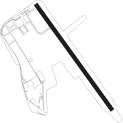
Guarujá - Base Aerea De Santos
Airport details
| Country | Brazil |
| State | São Paulo |
| Region | SB |
| Airspace | Curitiba Ctr |
| Municipality | Guarujá |
| Elevation | 8ft (2m) |
| Timezone | GMT -3 |
| Coordinates | -23.92554, -46.30083 |
| Magnetic var | |
| Type | land |
| Available since | X-Plane v10.40 |
| ICAO code | SBST |
| IATA code | SSZ |
| FAA code | n/a |
Communication
| BASE AEREA DE SANTOS Tower | 118.300 |
| BASE AEREA DE SANTOS Tower | 122.800 |
| BASE AEREA DE SANTOS SAO PAULO Approach | 119.800 |
| BASE AEREA DE SANTOS SAO PAULO Approach | 120.050 |
| BASE AEREA DE SANTOS SAO PAULO Approach | 129.500 |
Nearby Points of Interest:
Outeiro de Santa Catarina
-Casa do Trem Bélico
-Church of the Order Terceira do Carmo
-Portuguese Cultural Centre
-Barnabé State School
-Frontaria Azulejada House
-Casarão do Valongo
-Santos seashore gardens
-Dona Escolástica Rosa State Technical School
-Building Over The Waves
-Casa da Pedra
-São Vicente Suspension Bridge
-Paranapiacaba Funicular
-Forte de São João da Bertioga
-Forte de São Filipe da Bertioga
-Capela do Pilar
-Pinacoteca de Mogi das Cruzes
-Casa do Sítio da Ressaca
-Capela do Cristo Operário
-Building of the Antarctica Paulista Company
-Residence of Maestro Furio Franceschini
-Congonhas-São Paulo Airport
-Capela do Bom Jesus do Horto
-Casa Modernista
-Centro de Memória do Corpo de Bombeiros
Nearby beacons
| code | identifier | dist | bearing | frequency |
|---|---|---|---|---|
| RDE | REDE (SAO PAULO) VOR/DME | 12.6 | 279° | 116.70 |
| DAD | DIADEMA (SAO PAULO) NDB | 21.1 | 306° | 200 |
| CGO | CONGONHAS (SAO PAULO) VOR/DME | 26.4 | 310° | 116.90 |
| EMB | EMBUGUACU (SAO PAULO) NDB | 28.6 | 278° | 525 |
| BCO | BONSUCESSO (SAO PAULO) VOR/DME | 31.5 | 351° | 116 |
| IG | TUCA (SAO PAULO) NDB | 31.6 | 330° | 410 |
| STN | SANTANA (SAO PAULO TMA) VOR/DME | 43.1 | 305° | 114.30 |
| SCP | SAO JOSE (SAO JOSE DOS CA VOR/DME | 48.1 | 32° | 115.40 |
| BGC | BRAGANCA (BRAGANCA PAULIS VOR/DME | 60.3 | 345° | 116.20 |
| TBE | TAUBATE NDB | 68.2 | 42° | 430 |
| TAU | TAUBATE VOR/DME | 68.8 | 42° | 112.60 |
| CPN | CAMPINAS VOR/DME | 71.5 | 318° | 112 |
Departure and arrival routes
| Transition altitude | 6000ft |
| SID end points | distance | outbound heading | |
|---|---|---|---|
| RW17 | |||
| DOMK1A | 65mi | 17° | |
| RW35 | |||
| DOMK1A | 65mi | 17° | |
Instrument approach procedures
| runway | airway (heading) | route (dist, bearing) |
|---|---|---|
| RW35-Z | ST004 (337°) | ST004 5000ft ST003 (7mi, 338°) 2900ft |
| RW35-Z | ST006 (9°) | ST006 5000ft ST003 (7mi, 71°) 2900ft |
| RW35-Z | ST007 (307°) | ST007 5000ft ST003 (7mi, 251°) 2900ft |
| RNAV | ST003 2900ft ST002 (7mi, 338°) 2100ft SDF05 (2mi, 338°) 1252ft ST001 (2mi, 338°) 343ft (3053mi, 63°) 1300ft ST006 (3060mi, 242°) 5000ft ST006 (turn) 5000ft |
Disclaimer
The information on this website is not for real aviation. Use this data with the X-Plane flight simulator only! Data taken with kind consent from X-Plane 12 source code and data files. Content is subject to change without notice.