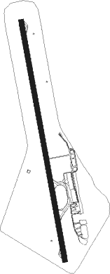
Teresina - Senador Petronio Portella
Airport details
| Country | Brazil |
| State | Piauí |
| Region | SB |
| Airspace | Recife Ctr |
| Municipality | Teresina |
| Elevation | 219ft (67m) |
| Timezone | GMT -3 |
| Coordinates | -5.06056, -42.82444 |
| Magnetic var | |
| Type | land |
| Available since | X-Plane v10.40 |
| ICAO code | SBTE |
| IATA code | THE |
| FAA code | n/a |
Communication
| Senador Petronio Portella TERESINA ATIS | 127.800 |
| Senador Petronio Portella Tower | 118.800 |
| Senador Petronio Portella TERESINA Approach | 119.600 |
Nearby beacons
| code | identifier | dist | bearing | frequency |
|---|---|---|---|---|
| TNA | TERESINA VOR/DME | 0.1 | 200° | 112.90 |
Departure and arrival routes
| Transition altitude | 4000ft |
| SID end points | distance | outbound heading | |
|---|---|---|---|
| RW02 | |||
| SIKI1C, SIKI1D | 40mi | 27° | |
| RW20 | |||
| ETIR1B, ETIR1C | 40mi | 27° | |
Instrument approach procedures
| runway | airway (heading) | route (dist, bearing) |
|---|---|---|
| RW02 | TE361 (18°) | TE361 4000ft TE364 (6mi, 64°) 1900ft |
| RW02 | TE362 (354°) | TE362 4000ft TE364 (6mi, 354°) 1900ft |
| RW02 | TE363 (330°) | TE363 4000ft TE364 (6mi, 284°) 1900ft |
| RNAV | TE364 1900ft TE366 (5mi, 354°) 1860ft SBTE (6mi, 354°) 269ft (2586mi, 83°) 2000ft TE363 (2581mi, 263°) 4000ft TE363 (turn) 4000ft | |
| RW20 | TE368 (198°) | TE368 3300ft TE367 (6mi, 244°) 1900ft |
| RW20 | TE369 (174°) | TE369 3300ft TE367 (6mi, 174°) 1900ft |
| RW20 | TE371 (150°) | TE371 3300ft TE367 (6mi, 104°) 1900ft |
| RNAV | TE367 1900ft TE372 (5mi, 174°) 1840ft SBTE (6mi, 174°) 245ft (2586mi, 83°) 2000ft TE368 (2581mi, 264°) 3300ft TE368 (turn) 3300ft |
Disclaimer
The information on this website is not for real aviation. Use this data with the X-Plane flight simulator only! Data taken with kind consent from X-Plane 12 source code and data files. Content is subject to change without notice.
