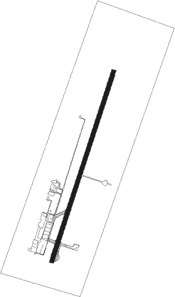
Uberlândia - Ten Cel Av Cesar Bombonato
Airport details
| Country | Brazil |
| State | Minas Gerais |
| Region | SB |
| Airspace | Brasilia Ctr |
| Municipality | Uberlândia |
| Elevation | 3094ft (943m) |
| Timezone | GMT -3 |
| Coordinates | -18.88361, -48.22528 |
| Magnetic var | |
| Type | land |
| Available since | X-Plane v10.40 |
| ICAO code | SBUL |
| IATA code | UDI |
| FAA code | n/a |
Communication
| TEN CEL AV CESAR BOMBONATO Tower | 118.800 |
| TEN CEL AV CESAR BOMBONATO Approach | 121.500 |
| TEN CEL AV CESAR BOMBONATO Approach | 120.800 |
Approach frequencies
| ILS-cat-I | RW04 | 109.3 | 18.00mi |
| 3° GS | RW04 | 109.3 | 18.00mi |
Nearby beacons
| code | identifier | dist | bearing | frequency |
|---|---|---|---|---|
| ULD | UBERLANDIA NDB | 0.3 | 233° | 350 |
| ULD | UBERLANDIA VOR/DME | 0.4 | 30° | 116.10 |
| URB | UBERABA NDB | 55 | 163° | 235 |
Departure and arrival routes
| Transition altitude | 6000ft |
| SID end points | distance | outbound heading | |
|---|---|---|---|
| RW04 | |||
| PABI1B | 66mi | 2° | |
| VALA1A | 41mi | 6° | |
| UBSU1B | 21mi | 9° | |
| VUKE1A | 45mi | 41° | |
| ISRI1B | 63mi | 104° | |
| TOPI1A | 66mi | 140° | |
| KIGU1B | 27mi | 163° | |
| SAKR1B | 34mi | 211° | |
| UDIG1B, TIKS1A | 30mi | 237° | |
| EDMI1B | 26mi | 298° | |
| GUAR1B | 20mi | 335° | |
| SIRU1B | 73mi | 345° | |
| MULU1B | 28mi | 358° | |
| RW22 | |||
| PABI1B | 66mi | 2° | |
| POVG1A | 41mi | 6° | |
| RENE1A | 45mi | 41° | |
| URB1B | 55mi | 163° | |
| MOVT1B | 58mi | 340° | |
| CAL1B | 73mi | 342° | |
| NIDS1B | 78mi | 358° | |
Instrument approach procedures
| runway | airway (heading) | route (dist, bearing) |
|---|---|---|
| RW04 | UL001 (48°) | UL001 6000ft UL004 (6mi, 93°) 4800ft |
| RW04 | UL002 (24°) | UL002 6000ft UL004 (5mi, 24°) 4800ft |
| RW04 | UL003 (359°) | UL003 6000ft UL004 (6mi, 311°) 4800ft |
| RNAV | UL004 4800ft UL006 (5mi, 24°) 4730ft SBUL (6mi, 24°) 3138ft UL008 (16mi, 24°) 6000ft UL008 (turn) 6000ft | |
| RW22 | UL008 (204°) | UL008 6000ft UL012 (5mi, 203°) 4800ft |
| RW22 | UL009 (228°) | UL009 6000ft UL012 (6mi, 273°) 4800ft |
| RW22 | UL011 (179°) | UL011 6000ft UL012 (6mi, 132°) 4800ft |
| RNAV | UL012 4800ft UL007 (5mi, 203°) 4730ft SBUL (6mi, 204°) 3138ft UL002 (16mi, 204°) 6000ft UL002 (turn) 6000ft |
Disclaimer
The information on this website is not for real aviation. Use this data with the X-Plane flight simulator only! Data taken with kind consent from X-Plane 12 source code and data files. Content is subject to change without notice.
