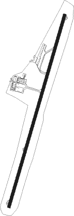
Varginha - Varginha Airport
Airport details
| Country | Brazil |
| State | Minas Gerais |
| Region | SB |
| Airspace | Brasilia Ctr |
| Municipality | Varginha |
| Elevation | 3026ft (922m) |
| Timezone | GMT -3 |
| Coordinates | -21.58889, -45.47333 |
| Magnetic var | |
| Type | land |
| Available since | X-Plane v10.40 |
| ICAO code | SBVG |
| IATA code | VAG |
| FAA code | n/a |
Communication
| Varginha Airport RDO | 131.800 |
Nearby Points of Interest:
Parish Church of Our Lady of the Rosary
Nearby beacons
| code | identifier | dist | bearing | frequency |
|---|---|---|---|---|
| FUR | FURNAS (ALPINOPOLIS) NDB | 71.8 | 316° | 390 |
Departure and arrival routes
| Transition altitude | 6000ft |
| Transition level | 60ft |
| SID end points | distance | outbound heading | |
|---|---|---|---|
| RW04 | |||
| OMNI | 56mi | 256° | |
| RW22 | |||
| OMNI | 56mi | 256° | |
Instrument approach procedures
| runway | airway (heading) | route (dist, bearing) |
|---|---|---|
| RW04 | VG361 (22°) | VG361 7000ft VG363 (5mi, 22°) 5200ft |
| RW04 | VG362 (0°) | VG362 7000ft VG363 (5mi, 309°) 5200ft |
| RW04 | VG364 (44°) | VG364 7000ft VG363 (5mi, 91°) 5200ft |
| RNAV | VG363 5200ft VG366 (5mi, 22°) 4770ft VG001 (2mi, 22°) 3988ft SBVG (3mi, 22°) 3070ft VG367 (15mi, 22°) 6000ft VG367 (turn) 6000ft | |
| RW22 | VG367 (202°) | VG367 7000ft VG369 (5mi, 202°) 5200ft |
| RW22 | VG368 (180°) | VG368 7000ft VG369 (5mi, 129°) 5200ft |
| RW22 | VG371 (224°) | VG371 7000ft VG369 (5mi, 271°) 5200ft |
| RNAV | VG369 5200ft VG372 (5mi, 202°) 4750ft VG002 (2mi, 202°) 4187ft VG003 (2mi, 202°) 3709ft SBVG (2mi, 203°) 3072ft VG361 (16mi, 202°) 6000ft VG361 (turn) 6000ft |
Disclaimer
The information on this website is not for real aviation. Use this data with the X-Plane flight simulator only! Data taken with kind consent from X-Plane 12 source code and data files. Content is subject to change without notice.