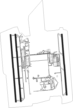
Pirassununga - Campo Fontenelle
Airport details
| Country | Brazil |
| State | São Paulo |
| Region | SB |
| Airspace | Brasilia Ctr |
| Municipality | Pirassununga |
| Elevation | 1964ft (599m) |
| Timezone | GMT -3 |
| Coordinates | -21.97524, -47.33942 |
| Magnetic var | |
| Type | land |
| Available since | X-Plane v10.40 |
| ICAO code | SBYS |
| IATA code | QPS |
| FAA code | n/a |
Communication
| Campo Fontenelle Ground Control | 121.900 |
| Campo Fontenelle ACADEMIA Tower | 122.800 |
| Campo Fontenelle ACADEMIA Tower | 118.300 |
| Campo Fontenelle ACADEMIA Approach | 120.100 |
| Campo Fontenelle ACADEMIA Approach | 122.400 |
Approach frequencies
| ILS-cat-I | RW02C | 109.3 | 18.00mi |
| 3° GS | RW02C | 109.3 | 18.00mi |
Nearby beacons
| code | identifier | dist | bearing | frequency |
|---|---|---|---|---|
| PIR | PIRASSUNUNGA VOR/DME | 0.6 | 209° | 115.80 |
| PSN | PIRASSUNUNGA NDB | 0.6 | 170° | 310 |
| RCL | RIO CLARO NDB | 30 | 206° | 280 |
| PCL | POCOS (POCOS DE CALDAS) NDB | 43.9 | 80° | 415 |
| AAQ | ARARAQUARA NDB | 45.6 | 281° | 205 |
| RPR | RIBEIRAO (RIBEIRAO PRETO) VOR/DME | 55.4 | 333° | 115.60 |
| RPR | RIBEIRAO (RIBEIRAO PRETO) NDB | 55.6 | 332° | 330 |
| IK | BENTO (CAMPINAS) NDB | 59.4 | 172° | 370 |
| BGC | BRAGANCA (BRAGANCA PAULIS VOR/DME | 72.5 | 142° | 116.20 |
Departure and arrival routes
| Transition altitude | 7000ft |
| SID end points | distance | outbound heading | |
|---|---|---|---|
| RW02 (ALL) | |||
| NIMPU | 39mi | 6° | |
| EGBAL | 71mi | 22° | |
| ILVIV | 105mi | 64° | |
| MUDRU | 69mi | 79° | |
| MOLVA | 97mi | 89° | |
| OPRUT | 55mi | 93° | |
| NILPI | 36mi | 99° | |
| LIVED | 55mi | 131° | |
| BOLIN | 47mi | 131° | |
| PADAV | 54mi | 195° | |
| RCL | 30mi | 206° | |
| MOXAV | 69mi | 259° | |
| AAQ | 46mi | 281° | |
| RPR, KALU | 55mi | 333° | |
| RW02C | |||
| GIBM1A | 101mi | 341° | |
| RW20 (ALL) | |||
| NIMPU | 39mi | 6° | |
| EGBAL | 71mi | 22° | |
| ILVIV | 105mi | 64° | |
| MUDRU | 69mi | 79° | |
| MOLVA | 97mi | 89° | |
| OPRUT | 55mi | 93° | |
| NILPI | 36mi | 99° | |
| BOLIN | 47mi | 131° | |
| LIVED | 55mi | 131° | |
| PADAV | 54mi | 195° | |
| RCL | 30mi | 206° | |
| MOXAV | 69mi | 259° | |
| AAQ | 46mi | 281° | |
| KALU, RPR | 55mi | 333° | |
| RW20C | |||
| KAMU1A | 101mi | 341° | |
Instrument approach procedures
| runway | airway (heading) | route (dist, bearing) |
|---|---|---|
| RW02C | YS003 (30°) | YS003 5000ft YS002 (6mi, 90°) 3610ft |
| RW02C | YS004 (330°) | YS004 5000ft YS002 (6mi, 270°) 3610ft |
| RW02C | YS006 (0°) | YS006 5000ft YS002 (6mi, 360°) 3610ft |
| RNAV | YS002 3610ft YS001 (5mi, 360°) 3610ft YS007 (3mi, 360°) 2701ft SBYS (3mi, 2°) 2018ft (3067mi, 65°) 4000ft YS003 (3076mi, 245°) 5000ft YS003 (turn) 5000ft | |
| RW20C | YS011 (212°) | YS011 5000ft YS013 (6mi, 270°) 3900ft |
| RW20C | YS012 (147°) | YS012 5000ft YS013 (6mi, 90°) 3900ft |
| RW20C | YS014 (179°) | YS014 5200ft YS013 (6mi, 180°) 3900ft |
| RNAV | YS013 3900ft YS009 (5mi, 180°) 3610ft YS008 (3mi, 180°) 2701ft SBYS (2mi, 177°) 2012ft (3067mi, 65°) 4000ft YS012 (3069mi, 245°) 5000ft YS012 (turn) 5000ft |
Disclaimer
The information on this website is not for real aviation. Use this data with the X-Plane flight simulator only! Data taken with kind consent from X-Plane 12 source code and data files. Content is subject to change without notice.

