Manning - Palmetto Air Plantation
Airport details
| Country | United States of America |
| State | South Carolina |
| Region | |
| Airspace | Jacksonville Ctr |
| Municipality | Clarendon County |
| Elevation | 104ft (32m) |
| Timezone | GMT -5 |
| Coordinates | 33.66918, -80.25089 |
| Magnetic var | |
| Type | land |
| Available since | X-Plane v10.40 |
| ICAO code | SC41 |
| IATA code | n/a |
| FAA code | SC41 |
Communication
| Palmetto Air Plantation UNICOM | 122.800 |
Nearby Points of Interest:
Davis House
-Alderman's 20 Stores in One
-Manning Commercial Historic District
-Manning Library
-Summerton High School
-Senn's Grist Mill-Blacksmith Shop-Orange Crush Bottling Plant
-James Building (Summerton, South Carolina)
-J. Clinton Brogdon House
-Pinewood Depot
-Santee Indian Mound and Fort Watson
-Rip Raps Plantation
-Millford Plantation
-O'Donnell House
-Sumter Historic District
-Sumter Town Hall-Opera House
-Carnegie Public Library
-Eutaw Springs Battleground Park
-Sumter County Courthouse
-Elizabeth White House
-Henry Lee Scarborough House
-Santee Canal
-Charles T. Mason House
-Loch Dhu
-Numertia Plantation
-Heriot-Moise House
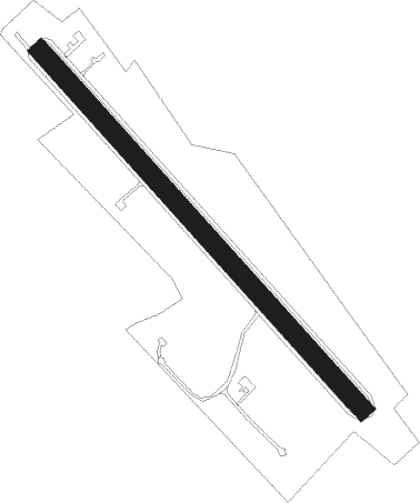
Runway info
| Runway 16 / 34 | ||
| length | 1135m (3724ft) | |
| bearing | 137° / 317° | |
| width | 46m (151ft) | |
| surface | grass | |
Nearby beacons
| code | identifier | dist | bearing | frequency |
|---|---|---|---|---|
| MNI | MANNING NDB | 5.3 | 151° | 381 |
| VAN | VANCE VORTAC | 15.3 | 225° | 110.40 |
| SMS | SUMTER NDB | 20 | 341° | 252 |
| SSC | SHAW (SUMTER) TACAN | 21.4 | 325° | 110.10 |
| CFY | EVANS (LAKE CITY) NDB | 26.6 | 69° | 420 |
| MMT | MC ENTIRE (COLUMBIA) VORTAC | 31.4 | 295° | 113.20 |
| FL | ALCOT (FLORENCE) NDB | 36.2 | 38° | 335 |
| DYB | DORCHESTER COUNTY(SUMMERVILLE) NDB | 36.5 | 182° | 365 |
| PHH | ANDREWS NDB | 38.5 | 107° | 255 |
| CAE | COLUMBIA VORTAC | 41.6 | 283° | 114.70 |
| CH | ASHLY (CHARLESTON) NDB | 42.3 | 168° | 329 |
| HVS | HARTSVILLE NDB | 44.7 | 10° | 341 |
| FLO | FLORENCE VORTAC | 44.9 | 46° | 115.20 |
| CHS | CHARLESTON VORTAC | 47.7 | 165° | 113.50 |
| UDG | DARLINGTON NDB | 49.8 | 25° | 245 |
| CA | MURRY (COLUMBIA) NDB | 52.7 | 287° | 362 |
| CTF | CHESTERFIELD VOR/DME | 58.9 | 359° | 108.20 |
| BES | BENNETTSVILLE NDB | 62.6 | 29° | 230 |
| DLC | DILLON NDB | 64.2 | 48° | 274 |
Disclaimer
The information on this website is not for real aviation. Use this data with the X-Plane flight simulator only! Data taken with kind consent from X-Plane 12 source code and data files. Content is subject to change without notice.