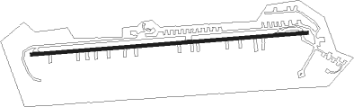
Lexington - White Plains
Airport details
| Country | United States of America |
| State | South Carolina |
| Region | K7 |
| Airspace | Jacksonville Ctr |
| Municipality | Lexington County |
| Elevation | 520ft (158m) |
| Timezone | GMT -5 |
| Coordinates | 33.96389, -81.35917 |
| Magnetic var | |
| Type | land |
| Available since | X-Plane v10.40 |
| ICAO code | SC99 |
| IATA code | n/a |
| FAA code | SC99 |
Communication
| White Plains CTAF | 123.000 |
Nearby Points of Interest:
John Solomon Hendrix House
-Lemuel Boozer House
-W. Q. M. Berly House
-William Berly House
-Charlton Rauch House
-Ernest L. Hazelius House
-David Rawl House
-Fox House
-Bank of Western Carolina
-Lexington County Courthouse
-Maj. Henry A. Meetze House
-Home National Bank
-Simmons-Harth House
-James Harman Building
-C.E. Corley House
-Church Street Historic District
-Rev. Frank Yarborough House
-Leesville College Historic District
-Thomas Galbraith Herbert House
-Ballentine-Shealy House
-D. D. D. Barr House
-Jacob Wingard Dreher House
-Henry Franklin Hendrix House
-Mitchell-Shealy House
-Old Batesburg-Leesville High School
Nearby beacons
| code | identifier | dist | bearing | frequency |
|---|---|---|---|---|
| CA | MURRY (COLUMBIA) NDB | 5.7 | 88° | 362 |
| CAE | COLUMBIA VORTAC | 16.5 | 109° | 114.70 |
| AIK | AIKEN NDB | 24.5 | 226° | 347 |
| EOE | ENOREE (NEWBERRY) NDB | 24.9 | 321° | 278 |
| MMT | MC ENTIRE (COLUMBIA) VORTAC | 27.8 | 94° | 113.20 |
| GIW | CORONACA (GREENWOOD) NDB | 40.1 | 292° | 239 |
| IRQ | COLLIERS VORTAC | 42.9 | 252° | 113.90 |
| GRD | GREENWOOD VORTAC | 43.1 | 290° | 115.50 |
| EMR | EMORY (AUGUSTA) NDB | 43.8 | 232° | 385 |
| SSC | SHAW (SUMTER) TACAN | 44.4 | 89° | 110.10 |
| UOT | UNION COUNTY NDB | 45.4 | 339° | 326 |
| SMS | SUMTER NDB | 49.7 | 88° | 252 |
| DCM | CHESTER NDB | 49.9 | 11° | 220 |
| AG | BUSHE (AUGUSTA) NDB | 50.1 | 221° | 233 |
| LKR | LANCASTER NDB | 51.8 | 33° | 400 |
| VAN | VANCE VORTAC | 54.1 | 118° | 110.40 |
| ALD | ALLENDALE VOR | 57.2 | 176° | 116.70 |
| UZ | RALLY (ROCK HILL) NDB | 57.3 | 17° | 227 |
| GM | JUDKY (GREENVILLE) NDB | 69.3 | 309° | 521 |
Disclaimer
The information on this website is not for real aviation. Use this data with the X-Plane flight simulator only! Data taken with kind consent from X-Plane 12 source code and data files. Content is subject to change without notice.