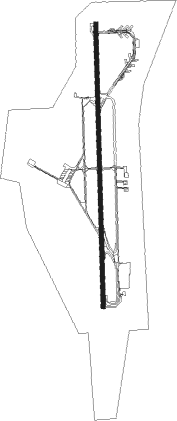
Iquique - Diego Aracena Intl
Airport details
| Country | Chile |
| State | Tarapacá Region |
| Region | SC |
| Airspace | Antofagasta Ctr |
| Municipality | Iquique |
| Elevation | 152ft (46m) |
| Timezone | GMT -4 |
| Coordinates | -20.53528, -70.18139 |
| Magnetic var | |
| Type | land |
| Available since | X-Plane v10.40 |
| ICAO code | SCDA |
| IATA code | IQQ |
| FAA code | n/a |
Communication
| Diego Aracena Intl Ground Control | 121.700 |
| Diego Aracena Intl IQUIQUE Tower | 118.900 |
| Diego Aracena Intl IQUIQUE Approach | 122.700 |
| Diego Aracena Intl IQUIQUE Approach | 124.900 |
Approach frequencies
| ILS-cat-I | RW19 | 109.9 | 18.00mi |
| 3.2° GS | RW19 | 109.9 | 18.00mi |
Nearby Points of Interest:
Cerro Dragón
-Casa Marinkovic
-Palacio Astoreca (Iquique)
-Parroquia Convento San Antonio de Padua
-Clock Tower
-Baquedano Street
-Edificio del ex Hotel La Bolsa
-Humberstone and Santa Laura Saltpeter Works
Nearby beacons
| code | identifier | dist | bearing | frequency |
|---|---|---|---|---|
| IQQ | IQUIQUE VOR/DME | 9.6 | 3° | 113.30 |
Departure and arrival routes
| Transition altitude | 6000ft |
| SID end points | distance | outbound heading | |
|---|---|---|---|
| RW01 | |||
| REPU3J | 69mi | 343° | |
| RW19 | |||
| AKNU2C, AKNU2B, AKNU2A | 45mi | 148° | |
| ENLU2A, ENLU3B | 82mi | 182° | |
| REBO2A, REBO2B, REBO2C | 84mi | 185° | |
| REPU3K | 69mi | 343° | |
| LOBAG2 | 67mi | 358° | |
| STAR starting points | distance | inbound heading | |
|---|---|---|---|
| ALL | |||
| GAXI3A | 83.9 | 15° | |
| BRAD3A | 87.3 | 23° | |
| VURE3A | 88.5 | 327° | |
| RW19 | |||
| GAXI4D, GAXI3C, GAXI3B | 83.9 | 15° | |
| BRAD2C | 87.3 | 23° | |
| LOKI4B, LOKI4A | 66.6 | 137° | |
| PUGOT3 | 69.8 | 176° | |
| LOBA3C, LOBA3B, LOBA3A | 66.5 | 178° | |
| VURE3B | 88.5 | 327° | |
| AKNUV3 | 44.9 | 328° | |
Instrument approach procedures
| runway | airway (heading) | route (dist, bearing) |
|---|---|---|
| RW01 | SIREX (28°) | SIREX 6000ft DA171 (5mi, 19°) 4800ft DA138 (3mi, 39°) 3900ft DA104 (3mi, 59°) 3000ft |
| RNAV | DA104 3000ft DA085 (2mi, 59°) 2700ft VUROV (3mi, 32°) 2300ft SCDA (7mi, 3°) 231ft DA050 (4mi, 3°) ETAPO (10mi, 317°) 4000ft ETAPO (turn) 4000ft | |
| RW19-Y | ETAPO (150°) | ETAPO 4000ft DA105 (5mi, 79°) 3200ft |
| RW19-Y | ISAMA (175°) | ISAMA 4000ft DA105 (5mi, 179°) 3200ft |
| RNAV | DA105 3200ft DA086 (3mi, 167°) 3000ft DA054 (2mi, 167°) 2300ft NIPNA (2mi, 167°) 1600ft DA010 (3mi, 183°) 489ft ETAPO (11mi, 325°) 3500ft ETAPO (turn) 3500ft | |
| RW19-Z | GETPI (46°) | GETPI 5000ft MIDIS (9mi, 360°) 3500ft |
| RW19-Z | SIREX (28°) | SIREX 6000ft GETPI (15mi, 21°) 5000ft MIDIS (9mi, 360°) 3500ft |
| RNAV | MIDIS 3500ft EKETU (3mi, 49°) 2500ft DALAD (3mi, 137°) 1260ft SCDA (4mi, 183°) 152ft VUMEK (turn) 600ft MAKLU (2mi, 201°) 1120ft ATOSI (2mi, 238°) 1750ft GETPI (2mi, 257°) 2300ft GETPI (turn) 5000ft |
Holding patterns
| STAR name | hold at | type | turn | heading* | altitude | leg | speed limit |
|---|---|---|---|---|---|---|---|
| AKNUV3 | SIREX | VHF | left | 205 (25)° | 1.0min timed | ICAO rules | |
| BRAD2C | SIREX | VHF | left | 205 (25)° | 1.0min timed | ICAO rules | |
| BRAD3A | SIREX | VHF | left | 205 (25)° | 1.0min timed | ICAO rules | |
| BRAD4B | BOKIK | VHF | right | 8 (188)° | 6000ft - 60000ft | DME 4.0mi | ICAO rules |
| GAXI3A | SIREX | VHF | left | 205 (25)° | 1.0min timed | ICAO rules | |
| GAXI3B | DA048 | VHF | left | 185 (5)° | > 8000ft | DME 7.0mi | ICAO rules |
| GAXI3C | DA048 | VHF | left | 185 (5)° | > 8000ft | DME 7.0mi | ICAO rules |
| GAXI4D | SIREX | VHF | left | 205 (25)° | 1.0min timed | ICAO rules | |
| LOBA3A | BOKIK | VHF | right | 8 (188)° | 6000ft - 60000ft | DME 4.0mi | ICAO rules |
| LOBA3C | OPNOR | VHF | right | 5 (185)° | DME 5.0mi | ICAO rules | |
| LOKI4B | OPNOR | VHF | right | 5 (185)° | DME 5.0mi | ICAO rules | |
| PUGOT3 | BOKIK | VHF | right | 8 (188)° | 6000ft - 60000ft | DME 4.0mi | ICAO rules |
| VURE3B | SIREX | VHF | left | 205 (25)° | 1.0min timed | ICAO rules | |
| *) magnetic outbound (inbound) holding course | |||||||
Disclaimer
The information on this website is not for real aviation. Use this data with the X-Plane flight simulator only! Data taken with kind consent from X-Plane 12 source code and data files. Content is subject to change without notice.