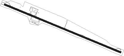
Isla De Pascua - Mataveri Intl
Airport details
| Country | Chile |
| State | Valparaiso Region |
| Region | SC |
| Airspace | Isla De Pascua Ctr |
| Municipality | Easter Island |
| Elevation | 226ft (69m) |
| Timezone | GMT -6 |
| Coordinates | -27.16472, -109.42167 |
| Magnetic var | |
| Type | land |
| Available since | X-Plane v10.40 |
| ICAO code | SCIP |
| IATA code | IPC |
| FAA code | n/a |
Communication
| Mataveri Intl PASCUA Tower | 118.100 |
| Mataveri Intl PASCUA Approach | 127.300 |
Approach frequencies
| ILS-cat-I | RW10 | 110.3 | 18.00mi |
| 2.5° GS | RW10 | 110.3 | 18.00mi |
Nearby beacons
| code | identifier | dist | bearing | frequency |
|---|---|---|---|---|
| IPA | ISLA DE PASCUA VOR/DME | 0.8 | 87° | 117.10 |
| R | MATAVERI INTL (ISLA DE PASCUA) NDB | 1.1 | 295° | 305 |
Departure and arrival routes
| Transition altitude | 3000ft |
| SID end points | distance | outbound heading | |
|---|---|---|---|
| RW10 | |||
| EROP2J | 61mi | 98° | |
| ASAL2J | 61mi | 117° | |
| HANP1A, HANP1B, HANP1E | 119mi | 276° | |
| RW28 | |||
| EROP2K | 61mi | 98° | |
| ASAL2K | 61mi | 117° | |
| HANP1C, HANP1D | 119mi | 276° | |
| STAR starting points | distance | inbound heading | |
|---|---|---|---|
| RW10 | |||
| EROP2A, EROP2B | 60.7 | 278° | |
| ASAL2A, ASAL2B | 60.6 | 297° | |
| RW28 | |||
| VUGS2D | 59.0 | 96° | |
| ASAL2C | 60.6 | 297° | |
Instrument approach procedures
| runway | airway (heading) | route (dist, bearing) |
|---|---|---|
| RW10-X | ITAPU (115°) | ITAPU 2500ft ORITU (6mi, 115°) 1300ft |
| RW10-X | PUBGO (330°) | PUBGO IP113 (17mi, 305°) 2500ft ORITU (5mi, 35°) 1300ft |
| RNAV | ORITU 1300ft SCIP (5mi, 114°) 177ft IP025 (2mi, 115°) POVKU (4mi, 114°) OPNUD (5mi, 114°) 2500ft OPNUD (turn) 2500ft | |
| RW10-Y | ESABA (262°) | ESABA 4000ft KONGA (22mi, 294°) 3000ft ITAPU (8mi, 210°) 2500ft |
| RW10-Y | ITAPU (115°) | ITAPU 2500ft |
| RW10-Y | KONGA (151°) | KONGA 3000ft ITAPU (8mi, 210°) 2500ft |
| RW10-Y | MADKU (82°) | MADKU 3000ft ITAPU (8mi, 30°) 2500ft |
| RW10-Y | PUBGO (330°) | PUBGO 4000ft MADKU (22mi, 295°) 3000ft ITAPU (8mi, 30°) 2500ft |
| RNAV | ITAPU 2500ft ORITU (6mi, 115°) 1300ft SCIP (5mi, 114°) 177ft (6439mi, 76°) 2500ft OPNUD (6428mi, 256°) 2500ft OPNUD (turn) 2500ft | |
| RW10-Z | ESABA (262°) | ESABA 4000ft KONGA (22mi, 294°) 3000ft ITAPU (8mi, 210°) 2500ft |
| RW10-Z | ITAPU (115°) | ITAPU 2500ft |
| RW10-Z | KONGA (151°) | KONGA 3000ft ITAPU (8mi, 210°) 2500ft |
| RW10-Z | MADKU (82°) | MADKU 3000ft ITAPU (8mi, 30°) 2500ft |
| RW10-Z | PUBGO (330°) | PUBGO 4000ft MADKU (22mi, 295°) 3000ft ITAPU (8mi, 30°) 2500ft |
| RNAV | ITAPU 2500ft ORITU (6mi, 115°) 1300ft TEMAN (2mi, 115°) 726ft (6441mi, 76°) 2500ft OPNUD (6428mi, 256°) 2500ft OPNUD (turn) 2500ft | |
| RW28-Y | ESABA (262°) | ESABA 3000ft OPNUD (8mi, 210°) 2500ft |
| RW28-Y | OPNUD (294°) | OPNUD 2500ft |
| RW28-Y | PUBGO (330°) | PUBGO 3000ft OPNUD (8mi, 30°) 2500ft |
| RNAV | OPNUD 2500ft POVKU (5mi, 294°) 1900ft SCIP (6mi, 295°) 282ft (6439mi, 76°) 1500ft OGTEG (6448mi, 256°) 2500ft OGTEG (turn) 2500ft | |
| RW28-Z | PUBGO (330°) | PUBGO 3000ft OPNUD (8mi, 30°) 2500ft |
| RNAV | OPNUD 2500ft POVKU (5mi, 294°) 1900ft SCIP (6mi, 295°) 282ft IP026 (2mi, 294°) ORITU (3mi, 295°) ITAPU (6mi, 295°) 2500ft ITAPU (turn) 2500ft |
Holding patterns
| STAR name | hold at | type | turn | heading* | altitude | leg | speed limit |
|---|---|---|---|---|---|---|---|
| ASAL2B | OGTEG | VHF | right | 283 (103)° | 1.0min timed | ICAO rules | |
| ASAL2C | OPNUD | VHF | right | 102 (282)° | 1.0min timed | ICAO rules | |
| EROP2B | OGTEG | VHF | right | 283 (103)° | 1.0min timed | ICAO rules | |
| VUGS2A | ITAPU | VHF | right | 282 (102)° | 1.0min timed | ICAO rules | |
| VUGS2B | OGTEG | VHF | right | 283 (103)° | 1.0min timed | ICAO rules | |
| *) magnetic outbound (inbound) holding course | |||||||
Disclaimer
The information on this website is not for real aviation. Use this data with the X-Plane flight simulator only! Data taken with kind consent from X-Plane 12 source code and data files. Content is subject to change without notice.
