Santiago - Municipal De Vitacura
Airport details
| Country | Chile |
| State | Santiago Metropolitan Region |
| Region | SC |
| Airspace | Santiago Ctr |
| Municipality | Vitacura |
| Elevation | 2250ft (686m) |
| Timezone | GMT -3 |
| Coordinates | -33.38306, -70.58195 |
| Magnetic var | |
| Type | land |
| Available since | X-Plane v10.40 |
| ICAO code | SCLC |
| IATA code | n/a |
| FAA code | n/a |
Communication
Nearby Points of Interest:
Casa de Asturias 400
-Palacio Riesco
-Casa presidencial de Tomás Moro
-Los Dominicos Park
-Piscina Tupahue
-Palacio Schacht
-Benedictine Monastery of the Holy Trinity (Las Condes)
-Manuel Foster Observatory
-Población William Noon
-Calle Keller
-Patio 29
-Población de la Caja del Seguro Obrero
-Funicular de Santiago
-Iglesia de la Epifanía del Señor
-Población León XIII
-Hospital del Salvador
-Casona de Las Condes
-Iglesia La Viñita
-Casco histórico del Cementerio General
-Antiguo Hospital San José
-Población Empleados Públicos y Periodistas Chile-España
-Capilla del antiguo Lazareto de San Vicente de Paul
-Puente Purísima
-Chilean Writers' Society
-Casa del Escritor
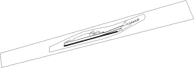
Runway info
| Runway 07 / 25 | ||
| length | 752m (2467ft) | |
| bearing | 81° / 261° | |
| width | 10m (33ft) | |
| surface | asphalt | |
| displ threshold | 0m (0ft) / 204m (669ft) | |
Nearby beacons
| code | identifier | dist | bearing | frequency |
|---|---|---|---|---|
| AMB | SANTIAGO VOR/DME | 10.3 | 260° | 116.10 |
| PDH | PUDAHUEL (SANTIAGO) VOR/DME | 11.1 | 262° | 117.20 |
| BQE | EL BOSQUE VOR/DME | 12.1 | 211° | 117.50 |
| TBN | TABON VOR/DME | 30.7 | 331° | 113.90 |
| VDM | VINA DEL MAR VOR/DME | 51.9 | 296° | 114.90 |
| SAL | SALINAS NDB | 53.5 | 293° | 390 |
| VTN | VENTANAS VOR/DME | 60.1 | 305° | 113.30 |
Disclaimer
The information on this website is not for real aviation. Use this data with the X-Plane flight simulator only! Data taken with kind consent from X-Plane 12 source code and data files. Content is subject to change without notice.