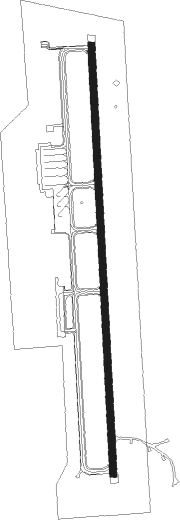
Puerto Montt - El Tepual
Airport details
| Country | Chile |
| State | Los Lagos Region |
| Region | SC |
| Airspace | Puerto Montt Ctr |
| Municipality | Puerto Montt |
| Elevation | 291ft (89m) |
| Timezone | GMT -4 |
| Coordinates | -41.43889, -73.09389 |
| Magnetic var | |
| Type | land |
| Available since | X-Plane v10.40 |
| ICAO code | SCTE |
| IATA code | PMC |
| FAA code | n/a |
Communication
| El Tepual Ground Control | 121.900 |
| El Tepual Tower | 118.100 |
| El Tepual RADAR | 121.300 |
Approach frequencies
| ILS-cat-I | RW35 | 110.1 | 18.00mi |
| 3° GS | RW35 | 110.1 | 18.00mi |
Nearby beacons
| code | identifier | dist | bearing | frequency |
|---|---|---|---|---|
| MON | PUERTO MONTT VOR/DME | 0.5 | 11° | 115.70 |
| OSO | OSORNO VOR/DME | 49.2 | 3° | 112.50 |
| MPI | MOCOPULLI VOR/DME | 60.9 | 214° | 113.30 |
Departure and arrival routes
| Transition altitude | 3000ft |
| SID end points | distance | outbound heading | |
|---|---|---|---|
| RW17 | |||
| KIKO2D, KIKO2B | 31mi | 0° | |
| ANRO2B | 67mi | 10° | |
| VOVK2B | 21mi | 11° | |
| CALB2B | 25mi | 81° | |
| GUTI4B, GUTI4C | 59mi | 164° | |
| OSAR3J, OSAR3D | 61mi | 169° | |
| RW35 | |||
| KIKO5C, KIKO4A | 31mi | 0° | |
| ANRO5A | 67mi | 10° | |
| VOVK4A | 21mi | 11° | |
| CALB4A | 25mi | 81° | |
| GUTI2D, GUTI2A | 59mi | 164° | |
| OSAR2E, OSAR2K | 61mi | 169° | |
| STAR starting points | distance | inbound heading | |
|---|---|---|---|
| ALL | |||
| MIDOR5 | 57.3 | 261° | |
| RW17 | |||
| CAUK4B | 59.4 | 6° | |
| SART1B | 30.6 | 200° | |
| OSAR3B | 60.9 | 349° | |
| GENE4B, GENE4C | 55.5 | 353° | |
| RW35 | |||
| CAUK2A | 59.4 | 6° | |
| SART1A | 30.6 | 200° | |
| OSAR2A | 60.9 | 349° | |
| GENE2A | 55.5 | 353° | |
Instrument approach procedures
| runway | airway (heading) | route (dist, bearing) |
|---|---|---|
| RW17 | AURES (182°) | AURES 3000ft |
| RW17 | GEBAP (39°) | GEBAP 4000ft TE270 (10mi, 3°) 4000ft ESLEG (11mi, 2°) 4000ft AURES (6mi, 91°) 3000ft |
| RW17 | TE350 (308°) | TE350 5000ft TE269 (8mi, 353°) 4000ft SARSU (11mi, 353°) 4000ft AURES (6mi, 271°) 3000ft |
| RNAV | AURES 3000ft BRAUN (6mi, 182°) 1600ft SCTE (5mi, 182°) 314ft (4649mi, 60°) 3000ft SILAS (4651mi, 240°) 3000ft SILAS (turn) 3000ft | |
| RW35 | SARSU (218°) | SARSU 6000ft SELKO (21mi, 182°) 4000ft SILAS (6mi, 271°) 3000ft |
| RW35 | SILAS (2°) | SILAS 3000ft |
| RNAV | SILAS 3000ft OGLEN (6mi, 2°) 1600ft SCTE (5mi, 2°) 344ft (4649mi, 60°) 3000ft AURES (4647mi, 241°) 3000ft AURES (turn) 3000ft |
Holding patterns
| STAR name | hold at | type | turn | heading* | altitude | leg | speed limit |
|---|---|---|---|---|---|---|---|
| CAUK2A | SILAS | VHF | left | 174 (354)° | DME 4.0mi | ICAO rules | |
| GENE2A | SILAS | VHF | left | 174 (354)° | DME 4.0mi | ICAO rules | |
| OSAR2A | SILAS | VHF | left | 174 (354)° | DME 4.0mi | ICAO rules | |
| SART1A | SARSU | VHF | left | 353 (173)° | DME 5.0mi | ICAO rules | |
| SART1B | AURES | VHF | right | 354 (174)° | DME 4.0mi | ICAO rules | |
| *) magnetic outbound (inbound) holding course | |||||||
Disclaimer
The information on this website is not for real aviation. Use this data with the X-Plane flight simulator only! Data taken with kind consent from X-Plane 12 source code and data files. Content is subject to change without notice.
