Angra Dos Reis
Airport details
| Country | Brazil |
| State | Rio de Janeiro |
| Region | SB |
| Airspace | Curitiba Ctr |
| Municipality | Angra dos Reis |
| Elevation | 5ft (2m) |
| Timezone | GMT -3 |
| Coordinates | -22.97528, -44.30722 |
| Magnetic var | |
| Type | land |
| Available since | X-Plane v10.32 |
| ICAO code | SDAG |
| IATA code | n/a |
| FAA code | n/a |
Communication
Nearby Points of Interest:
Casa de Cultura Poeta Brasil dos Reis
-Bonfim's Chapel
-Ilha Grande State Park
-Mambucaba
-Praia do Sul Biological Reserve
-Solar Barão de Saí
-Pharmácia Popular
-Solar Aguiar Valim
-Railway Station Bananal
-Fazenda Resgate
-Santa Casa de Misericórdia de Paraty
-Fazenda Pau d'Alho
-Monumento Rodoviário da Rodovia Presidente Dutra
-Sobrado na Rua Nove de Julho, 136
-Sobrado do Capitão Silveira
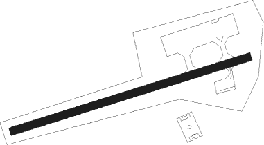
Runway info
| Runway 10 / 28 | ||
| length | 974m (3196ft) | |
| bearing | 78° / 258° | |
| width | 30m (98ft) | |
| surface | asphalt | |
| displ threshold | 0m (0ft) / 59m (194ft) | |
Nearby beacons
| code | identifier | dist | bearing | frequency |
|---|---|---|---|---|
| SCR | SANTA CRUZ (RIO) VOR/DME | 32.1 | 87° | 113.60 |
| PAI | PIRAI VOR/DME | 40.6 | 42° | 115 |
| NOA | NOVA (RIO DE JANEIRO TMA) NDB | 48.2 | 73° | 215 |
| GGT | GUARATINGUETA NDB | 51.4 | 282° | 275 |
| CAX | CAXIAS (RIO DE JANEIRO) NDB | 55.1 | 78° | 400 |
Instrument approach procedures
| runway | airway (heading) | route (dist, bearing) |
|---|---|---|
| RW10 | AG013 (24°) | AG013 4400ft AG016 (6mi, 304°) 2200ft |
| RW10 | VUREP (50°) | VUREP 4800ft AG016 (7mi, 40°) 2200ft |
| RNAV | AG016 2200ft AG017 (5mi, 38°) 1590ft AG018 (5mi, 66°) 555ft (2932mi, 63°) 2060ft AG013 (2938mi, 242°) 4400ft AG013 (turn) 4400ft |
Disclaimer
The information on this website is not for real aviation. Use this data with the X-Plane flight simulator only! Data taken with kind consent from X-Plane 12 source code and data files. Content is subject to change without notice.