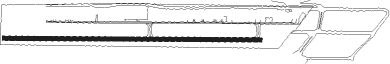
Americana
Airport details
| Country | Brazil |
| State | São Paulo |
| Region | SB |
| Airspace | Brasilia Ctr |
| Municipality | Americana |
| Elevation | 2083ft (635m) |
| Timezone | GMT -3 |
| Coordinates | -22.75579, -47.26944 |
| Magnetic var | |
| Type | land |
| Available since | X-Plane v10.40 |
| ICAO code | SDAI |
| IATA code | n/a |
| FAA code | n/a |
Communication
| Americana FCA Americana | 135.030 |
Nearby Points of Interest:
Fazenda Salto Grande
-Fazenda Santa Genebra
-Instituto Agronômico de Campinas
-Solar do Barão de Itapura
-Largo do Carmo (Campinas)
-Largo do Rosário
-Centro de Convivência
-Casa Grande e Tulha
-Sede da Fazenda Mato Dentro
-Luiz de Queiroz College of Agriculture
-Floresta Estadual Edmundo Navarro de Andrade
-Sobrado do Barão de Dourados
-Fazenda Grão Mogol
-Serra do Japi
-Complexo FEPASA
-Solar do Barão de Jundiaí
-Gabinete de Leitura Ruy Barbosa
-Biblioteca Municipal Nelson Foot
-Loja Maçônica Amor e Concórdia
Nearby beacons
| code | identifier | dist | bearing | frequency |
|---|---|---|---|---|
| IK | BENTO (CAMPINAS) NDB | 12.6 | 162° | 370 |
| CPN | CAMPINAS VOR/DME | 17 | 151° | 112 |
| RCL | RIO CLARO NDB | 25.4 | 318° | 280 |
| BGC | BRAGANCA (BRAGANCA PAULIS VOR/DME | 40.4 | 106° | 116.20 |
| SCB | SOROCABA (SAO PAULO TMA) VOR/DME | 45.5 | 188° | 115.20 |
| PSN | PIRASSUNUNGA NDB | 46.3 | 355° | 310 |
| PIR | PIRASSUNUNGA VOR/DME | 46.5 | 354° | 115.80 |
| STN | SANTANA (SAO PAULO TMA) VOR/DME | 47.9 | 155° | 114.30 |
| IG | TUCA (SAO PAULO) NDB | 57.2 | 135° | 410 |
| CGO | CONGONHAS (SAO PAULO) VOR/DME | 62.3 | 145° | 116.90 |
| BCO | BONSUCESSO (SAO PAULO) VOR/DME | 62.5 | 126° | 116 |
| PCL | POCOS (POCOS DE CALDAS) NDB | 67.6 | 37° | 415 |
| DAD | DIADEMA (SAO PAULO) NDB | 67.9 | 145° | 200 |
| AAQ | ARARAQUARA NDB | 74.4 | 317° | 205 |
Disclaimer
The information on this website is not for real aviation. Use this data with the X-Plane flight simulator only! Data taken with kind consent from X-Plane 12 source code and data files. Content is subject to change without notice.