Biritiba-mirim - Fazenda Irohy
Airport details
| Country | Brazil |
| State | São Paulo |
| Region | |
| Airspace | Curitiba Ctr |
| Municipality | Biritiba-Mirim |
| Elevation | 2466ft (752m) |
| Timezone | GMT -3 |
| Coordinates | -23.56193, -46.07587 |
| Magnetic var | |
| Type | land |
| Available since | X-Plane v10.40 |
| ICAO code | SDIH |
| IATA code | n/a |
| FAA code | n/a |
Communication
| Fazenda Irohy RDO | 123.450 |
Nearby Points of Interest:
Pinacoteca de Mogi das Cruzes
-Casa do Ajudante Braga
-Igreja de Nossa Senhora da Ajuda
-Forte de São João da Bertioga
-Forte de São Filipe da Bertioga
-Capela do Pilar
-Paranapiacaba Funicular
-House of Sítio Mirim
-Site of the Candinha
-Casa Amarela
-Capistrano de Abreu School
-Casa do Trem Bélico
-Outeiro de Santa Catarina
-Church of the Order Terceira do Carmo
-Igreja Matriz de Nossa Senhora da Penha de França
-Casarão do Valongo
-Frontaria Azulejada House
-Portuguese Cultural Centre
-Barnabé State School
-Sanatorium Padre Bento
-House of Tatuapé
-Santos seashore gardens
-Dona Escolástica Rosa State Technical School
-Building Over The Waves
-Casa da Pedra
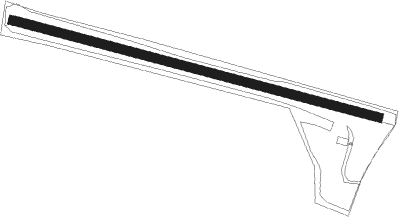
Runway info
| Runway 12 / 30 | ||
| length | 941m (3087ft) | |
| bearing | 108° / 288° | |
| width | 23m (75ft) | |
| surface | dirt | |
| displ threshold | 30m (98ft) / 40m (131ft) | |
Nearby beacons
| code | identifier | dist | bearing | frequency |
|---|---|---|---|---|
| BCO | BONSUCESSO (SAO PAULO) VOR/DME | 19.4 | 297° | 116 |
| SCP | SAO JOSE (SAO JOSE DOS CA VOR/DME | 23 | 33° | 115.40 |
| IG | TUCA (SAO PAULO) NDB | 28 | 281° | 410 |
| DAD | DIADEMA (SAO PAULO) NDB | 30.1 | 255° | 200 |
| RDE | REDE (SAO PAULO) VOR/DME | 31.7 | 234° | 116.70 |
| CGO | CONGONHAS (SAO PAULO) VOR/DME | 32 | 264° | 116.90 |
| TBE | TAUBATE NDB | 43.7 | 47° | 430 |
| EMB | EMBUGUACU (SAO PAULO) NDB | 44.2 | 249° | 525 |
| TAU | TAUBATE VOR/DME | 44.3 | 47° | 112.60 |
| BGC | BRAGANCA (BRAGANCA PAULIS VOR/DME | 45.6 | 321° | 116.20 |
| STN | SANTANA (SAO PAULO TMA) VOR/DME | 46.8 | 275° | 114.30 |
| PND | VIBASA (PINDAMONHANGABA) NDB | 56.9 | 47° | 205 |
| GGT | GUARATINGUETA NDB | 66.4 | 48° | 275 |
Disclaimer
The information on this website is not for real aviation. Use this data with the X-Plane flight simulator only! Data taken with kind consent from X-Plane 12 source code and data files. Content is subject to change without notice.