Nova Iguaçu - Aeroclube De Nova Iguaçu
Airport details
| Country | Brazil |
| State | Rio de Janeiro |
| Region | SB |
| Airspace | Curitiba Ctr |
| Municipality | Nova Iguaçu |
| Elevation | 164ft (50m) |
| Timezone | GMT -3 |
| Coordinates | -22.74667, -43.46472 |
| Magnetic var | |
| Type | land |
| Available since | X-Plane v10.30 |
| ICAO code | SDNY |
| IATA code | QNV |
| FAA code | n/a |
Communication
Nearby Points of Interest:
Fazenda São Bernardino
-House of the Viegas Estate
-Fazenda de São Bento
-Colônia Juliano Moreira
-Fazenda do Engenho d’ Água
-Fortim de Caetano Madeira
-Pedregulho Housing Complex
-Maracanã Village
-Casa da Marquesa de Santos
-Bishop’s House
-Palácio Duque de Caxias
-Pedra do Sal
-Palace of Itamaraty
-Fortaleza de Nossa Senhora da Conceição
-Palácio Episcopal (Rio de Janeiro)
-Casa Cavé
-Sítio Roberto Burle Marx
-Avenida Rio Branco
-Fortaleza de São José da Ilha das Cobras
-Chapel of Our Lady of Cabeça
-Santa Teresa Tram
-Carioca River
-Clube Naval
-Municipal Chamber of Rio de Janeiro
-Automóvel Clube do Brasil
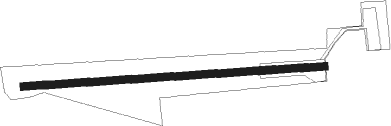
Runway info
| Runway 11 / 29 | ||
| length | 1124m (3688ft) | |
| bearing | 91° / 271° | |
| width | 28m (92ft) | |
| surface | asphalt | |
Nearby beacons
| code | identifier | dist | bearing | frequency |
|---|---|---|---|---|
| NOA | NOVA (RIO DE JANEIRO TMA) NDB | 1.9 | 331° | 215 |
| CAX | CAXIAS (RIO DE JANEIRO) NDB | 7.1 | 97° | 400 |
| CXI | GALEAO (RIO DE JANEIRO) VOR/DME | 12 | 109° | 112.30 |
| YLA | ILHA (RIO DE JANEIRO) NDB | 16.6 | 98° | 330 |
| PP | PAIOL (RIO DE JANEIRO) NDB | 18.1 | 112° | 415 |
| SCR | SANTA CRUZ (RIO) VOR/DME | 18.9 | 232° | 113.60 |
| IH | RASA (RIO DE JANEIRO TMA) NDB | 25.9 | 135° | 315 |
| PAI | PIRAI VOR/DME | 27.2 | 308° | 115 |
| PCX | PORTO (RIO DE JANEIRO TMA VOR/DME | 33.6 | 87° | 114.60 |
| MIA | MARICA VOR/DME | 34.4 | 111° | 114.80 |
| FRA | FORA (JUIZ DE FORA) NDB | 58.9 | 5° |
Disclaimer
The information on this website is not for real aviation. Use this data with the X-Plane flight simulator only! Data taken with kind consent from X-Plane 12 source code and data files. Content is subject to change without notice.