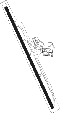
Bucaramanga - Palonegro
Airport details
| Country | Colombia |
| State | Santander |
| Region | SK |
| Airspace | Bogota Ctr |
| Municipality | Lebrija |
| Elevation | 3899ft (1188m) |
| Timezone | GMT -5 |
| Coordinates | 7.12663, -73.18266 |
| Magnetic var | |
| Type | land |
| Available since | X-Plane v10.40 |
| ICAO code | SKBG |
| IATA code | BGA |
| FAA code | n/a |
Communication
| Palonegro ATIS | 113.500 |
| Palonegro Metar | 128.750 |
| Palonegro Multicom | 126.700 |
| Palonegro Tower Frequency | 118.300 |
| Palonegro Approach Frequency | 119.000 |
Approach frequencies
| ILS-cat-I | RW35 | 110.7 | 18.00mi |
| 3° GS | RW35 | 110.7 | 18.00mi |
Nearby beacons
| code | identifier | dist | bearing | frequency |
|---|---|---|---|---|
| PIE | PIEDECUESTA VOR/DME | 15.5 | 160° | 116.80 |
| EJA | BARRANCABERMEJA VOR/DME | 37.5 | 261° | 115.90 |
| CUC | CUCUTA VOR/DME | 62.7 | 40° | 113.30 |
| UC | CUCUTA NDB | 63 | 39° | 264 |
| CU | CUCUTA NDB | 65.4 | 34° | 395 |
Departure and arrival routes
| Transition altitude | 18000ft |
| Transition level | 19000ft |
| SID end points | distance | outbound heading | |
|---|---|---|---|
| RW17 | |||
| ESNU1G, ESNU2J | 34mi | 49° | |
| VOVG1D, VOVG1B | 32mi | 114° | |
| MOGO1F, MOGO1G | 40mi | 169° | |
| UMKA1B | 21mi | 242° | |
| EJA1E, EJA1G | 38mi | 261° | |
| UBMU1B, UBMU2D | 17mi | 337° | |
| RW35 | |||
| ESNU2H, ESNU1F | 34mi | 49° | |
| VOVG1C, VOVG1A | 32mi | 114° | |
| MOGO1B, MOGO1E | 40mi | 169° | |
| UMKA1A | 21mi | 242° | |
| EJA1F, EJA1D | 38mi | 261° | |
| UBMU1A, UBMU1C | 17mi | 337° | |
| STAR starting points | distance | inbound heading | |
|---|---|---|---|
| ALL | |||
| OPRO1A | 33.3 | 9° | |
| EJA1H | 37.5 | 81° | |
| POXO1H | 20.0 | 82° | |
| IVRI1A | 16.9 | 133° | |
| TORA1Q | 36.9 | 208° | |
| VOVG1E | 32.3 | 294° | |
| MOGO2A | 40.0 | 349° | |
| RW17 | |||
| OPRO1C | 33.3 | 9° | |
| EJA2C | 37.5 | 81° | |
| POXO1J | 20.0 | 82° | |
| IVRI1C | 16.9 | 133° | |
| TORA1S | 36.9 | 208° | |
| VOVG1G | 32.3 | 294° | |
| MOGO2D | 40.0 | 349° | |
| RW35 | |||
| OPRO1B | 33.3 | 9° | |
| UMKA2C | 20.6 | 62° | |
| POXO2F | 20.0 | 82° | |
| IVRI1B | 16.9 | 133° | |
| TORA1R | 36.9 | 208° | |
| VOVG1F | 32.3 | 294° | |
| MOGO2C | 40.0 | 349° | |
Instrument approach procedures
| runway | airway (heading) | route (dist, bearing) |
|---|---|---|
| RW17 | KOKLA (129°) | KOKLA 7000ft OBKAX (6mi, 69°) 7000ft |
| RNAV | OBKAX 7000ft BG401 (5mi, 159°) 5510ft SKBG (5mi, 158°) 3951ft BG402 (5mi, 161°) 5100ft BG403 (7mi, 250°) 6200ft POXOM (15mi, 288°) 7000ft POXOM (turn) 7000ft | |
| RW35 | PIE (340°) | PIE 8000ft KILIB (5mi, 338°) 7000ft |
| RW35 | SIGOX (10°) | SIGOX 8000ft KILIB (6mi, 69°) 7000ft |
| RNAV | KILIB 7000ft ROLOV (5mi, 339°) 5500ft SKBG (6mi, 341°) 3904ft (4403mi, 96°) 6000ft POXOM (4423mi, 275°) 7000ft POXOM (turn) 7000ft |
Disclaimer
The information on this website is not for real aviation. Use this data with the X-Plane flight simulator only! Data taken with kind consent from X-Plane 12 source code and data files. Content is subject to change without notice.