Florencia - Gustavo Artunduaga Paredes
Airport details
| Country | Colombia |
| State | Caquetá |
| Region | SK |
| Airspace | Bogota Ctr |
| Municipality | Florencia |
| Elevation | 803ft (245m) |
| Timezone | GMT -5 |
| Coordinates | 1.58851, -75.55968 |
| Magnetic var | |
| Type | land |
| Available since | X-Plane v10.40 |
| ICAO code | SKFL |
| IATA code | FLA |
| FAA code | n/a |
Communication
| Gustavo Artunduaga Paredes Tower | 118.300 |
Runway info
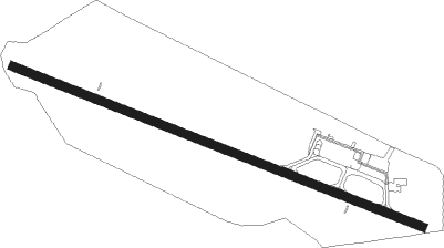
| Runway 12 / 30 | ||
| length | 1508m (4948ft) | |
| bearing | 116° / 296° | |
| width | 30m (98ft) | |
| surface | asphalt | |
Nearby beacons
| code | identifier | dist | bearing | frequency |
|---|---|---|---|---|
| FLA | FLORENCIA VOR/DME | 0.5 | 266° | 112.40 |
| TQS | TRES ESQUINAS NDB | 54.2 | 159° | 341 |
| TQS | TRES ESQUINAS VOR/DME | 54.4 | 159° | 114.20 |
| SVC | SAN VICENTE DEL CAGUAN VOR/DME | 58.2 | 54° | 116.50 |
Departure and arrival routes
| Transition altitude | 18000ft |
| Transition level | 19000ft |
| SID end points | distance | outbound heading | |
|---|---|---|---|
| RW12 | |||
| GAXA1H, GAXA1G | 19mi | 10° | |
| PADA1F | 14mi | 222° | |
| RW30 | |||
| GAXA1D | 19mi | 10° | |
| GEBU1A | 19mi | 277° | |
| KUDG1A | 23mi | 308° | |
| STAR starting points | distance | inbound heading | |
|---|---|---|---|
| ALL | |||
| PADA1G | 14.4 | 42° | |
| GEBU2A | 18.5 | 97° | |
| KUDG2A, KUDG2B | 22.8 | 128° | |
| GAXA1F | 19.2 | 190° | |
| REPE1A | 32.6 | 323° | |
Disclaimer
The information on this website is not for real aviation. Use this data with the X-Plane flight simulator only! Data taken with kind consent from X-Plane 12 source code and data files. Content is subject to change without notice.