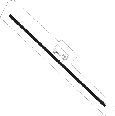
Montería - Los Garzones
Airport details
| Country | Colombia |
| State | Córdoba |
| Region | SK |
| Airspace | Barranquilla Ctr |
| Municipality | Montería |
| Elevation | 41ft (12m) |
| Timezone | GMT -5 |
| Coordinates | 8.82286, -75.82517 |
| Magnetic var | |
| Type | land |
| Available since | X-Plane v10.40 |
| ICAO code | SKMR |
| IATA code | MTR |
| FAA code | n/a |
Communication
| Los Garzones ATIS | 127.675 |
| Los Garzones LOS GARZONES Tower | 118.100 |
| Los Garzones Barranquilla FIC | 127.500 |
| Los Garzones BARRANQUILLA North Approach | 119.100 |
| Los Garzones BARRANQUILLA South Approach | 119.750 |
Approach frequencies
| ILS-cat-I | RW32 | 110.9 | 18.00mi |
| 3° GS | RW32 | 110.9 | 18.00mi |
Nearby beacons
| code | identifier | dist | bearing | frequency |
|---|---|---|---|---|
| MTR | MONTERIA VOR/DME | 0.7 | 336° | 114.80 |
| CZU | COROZAL VOR/DME | 44.5 | 47° | 113.40 |
| MGN | MAGANGUE VOR/DME | 64.3 | 65° | 114.10 |
Departure and arrival routes
| Transition altitude | 18000ft |
| Transition level | 19000ft |
| SID end points | distance | outbound heading | |
|---|---|---|---|
| RW14 | |||
| IRAX2F, IRAX2D | 42mi | 13° | |
| AKPA2C, AKPA1K | 45mi | 26° | |
| CZU1H, CZU2D | 45mi | 47° | |
| RAXO2D, RAXO1G, RAXO1E | 53mi | 172° | |
| AKPE1F, AKPE2D, AKPE2B | 50mi | 179° | |
| BOKU2D, BOKU2B, BOKU1F | 50mi | 222° | |
| MOVT1A | 104mi | 295° | |
| RW32 | |||
| IRAX1G, IRAX2E | 42mi | 13° | |
| AKPA2D, AKPA1J | 45mi | 26° | |
| CZU2C, CZU1G | 45mi | 47° | |
| RAXO1F, RAXO3B | 53mi | 172° | |
| AKPE3A, AKPE1E | 50mi | 179° | |
| BOKU3C, BOKU1E | 50mi | 222° | |
| MOVT1A | 104mi | 295° | |
| STAR starting points | distance | inbound heading | |
|---|---|---|---|
| RW14 | |||
| IRAX2C | 41.9 | 193° | |
| AKPA2B | 44.8 | 206° | |
| CZU2A | 44.5 | 227° | |
| RW32 | |||
| BOKU1G | 49.9 | 42° | |
| BOGA1A | 104.4 | 115° | |
| IRAX2K, IRAX2J, IRAX1L | 41.9 | 193° | |
| AKPA2H, AKPA2G, AKPA1L | 44.8 | 206° | |
| CZU2F, CZU2E, CZU1J | 44.5 | 227° | |
| XOGE1A | 100.0 | 308° | |
| BUTA3D, BUTA3C, BUTA1E | 62.1 | 339° | |
| RAXO4A, RAXO3C, RAXO1H | 53.4 | 352° | |
Instrument approach procedures
| runway | airway (heading) | route (dist, bearing) |
|---|---|---|
| RW32 | ARTAK (318°) | ARTAK 3000ft |
| RW32 | ESURU (343°) | ESURU 3000ft ARTAK (5mi, 48°) 3000ft |
| RW32 | SUGDI (292°) | SUGDI 3000ft ARTAK (5mi, 228°) 3000ft |
| RNAV | ARTAK 3000ft DINAB (5mi, 318°) 1700ft SKMR (6mi, 318°) 91ft PUMPA (12mi, 318°) 3000ft PUMPA (turn) 3000ft |
Disclaimer
The information on this website is not for real aviation. Use this data with the X-Plane flight simulator only! Data taken with kind consent from X-Plane 12 source code and data files. Content is subject to change without notice.
