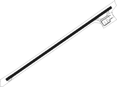
San Andrés - Gustavo Rojas Pinilla
Airport details
| Country | Colombia |
| State | San Andrés and Providencia |
| Region | SK |
| Airspace | Panama Ctr |
| Municipality | San Andrés |
| Elevation | 20ft (6m) |
| Timezone | GMT -5 |
| Coordinates | 12.58366, -81.71134 |
| Magnetic var | |
| Type | land |
| Available since | X-Plane v10.40 |
| ICAO code | SKSP |
| IATA code | ADZ |
| FAA code | n/a |
Communication
| Gustavo Rojas Pinilla MET | 127.800 |
| Gustavo Rojas Pinilla Tower | 118.100 |
| Gustavo Rojas Pinilla SAN ANDRES Approach | 119.300 |
Nearby beacons
| code | identifier | dist | bearing | frequency |
|---|---|---|---|---|
| SPP | SAN ANDRES VOR/DME | 0.3 | 101° | 113.30 |
Departure and arrival routes
| Transition altitude | 18000ft |
| Transition level | 19000ft |
| SID end points | distance | outbound heading | |
|---|---|---|---|
| RW06 | |||
| LEVO3B | 145mi | 3° | |
| TIMR3B | 183mi | 105° | |
| DAGA3B | 162mi | 110° | |
| BODE2B | 70mi | 132° | |
| BIXO2B | 71mi | 150° | |
| UGEV1B | 70mi | 207° | |
| AMUB3B | 83mi | 226° | |
| DURA3B | 65mi | 254° | |
| FALL3B | 76mi | 312° | |
| PELR4B | 109mi | 336° | |
| RW24 | |||
| LEVO3A | 145mi | 3° | |
| TIMR3A | 183mi | 105° | |
| DAGA3A | 162mi | 110° | |
| BODE2A | 70mi | 132° | |
| BIXO2A | 71mi | 150° | |
| UGEV1A | 70mi | 207° | |
| AMUB3A | 83mi | 226° | |
| DURA3A | 65mi | 254° | |
| FALL3A | 76mi | 312° | |
| PELR4A | 109mi | 336° | |
| STAR starting points | distance | inbound heading | |
|---|---|---|---|
| RW06 | |||
| UGEV1E, UGEV1C | 70.1 | 27° | |
| AMUB1C, AMUB1E | 82.7 | 46° | |
| DURA2C, DURA1E | 64.6 | 74° | |
| FALL1C, FALL1E | 75.6 | 132° | |
| PELR2C, PELR1E | 109.0 | 156° | |
| LEVO1C, LEVO1E | 145.2 | 183° | |
| PUMR1A, TIMR1C | 182.9 | 285° | |
| ENVE1A, DAGA1C | 161.7 | 290° | |
| BODE1E, BODE1C | 70.4 | 312° | |
| TOSA1A | 170.3 | 319° | |
| BIXO1E, BIXO1C | 70.5 | 330° | |
| RW24 | |||
| UGEV1D, UGEV1F | 70.1 | 27° | |
| AMUB1F, AMUB1D | 82.7 | 46° | |
| DURA1F, DURA1D | 64.6 | 74° | |
| FALL1F, FALL1D | 75.6 | 132° | |
| PELR2D, PELR1F | 109.0 | 156° | |
| LEVO1F, LEVO1D | 145.2 | 183° | |
| PUMR1B | 80.2 | 284° | |
| TIMR1D | 182.9 | 285° | |
| ENVE1B, DAGA1D | 161.7 | 290° | |
| BODE1F, BODE1D | 70.4 | 312° | |
| TOSA1B | 170.3 | 319° | |
| BIXO1F, BIXO1D | 70.5 | 330° | |
Instrument approach procedures
| runway | airway (heading) | route (dist, bearing) |
|---|---|---|
| RW06 | BOGOX (60°) | BOGOX 3000ft |
| RW06 | LIVIV (31°) | LIVIV 4000ft BOGOX (6mi, 329°) 3000ft |
| RW06 | UTNUT (89°) | UTNUT 4000ft BOGOX (6mi, 149°) 3000ft |
| RNAV | BOGOX 3000ft AKRUX (5mi, 60°) 1650ft SKSP (6mi, 60°) 70ft MUMOM (16mi, 60°) 3000ft MUMOM (turn) 3000ft | |
| RW24 | ANPID (240°) | ANPID 3000ft |
| RW24 | MOXIP (212°) | MOXIP 4000ft ANPID (6mi, 150°) 3000ft |
| RW24 | SAKSI (269°) | SAKSI 4000ft ANPID (6mi, 330°) 3000ft |
| RNAV | ANPID 3000ft NIKLA (5mi, 240°) 1700ft SKSP (6mi, 240°) 55ft BOGOX (11mi, 240°) 1900ft BOGOX (turn) 3000ft |
Disclaimer
The information on this website is not for real aviation. Use this data with the X-Plane flight simulator only! Data taken with kind consent from X-Plane 12 source code and data files. Content is subject to change without notice.
