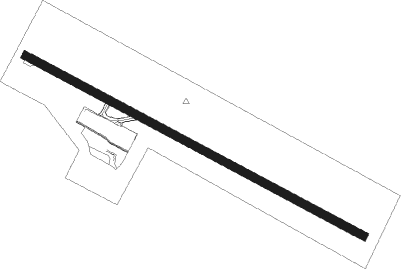
Quibdó - El Caraño
Airport details
| Country | Colombia |
| State | Chocó |
| Region | SK |
| Airspace | Bogota Ctr |
| Municipality | Quibdó |
| Elevation | 204ft (62m) |
| Timezone | GMT -5 |
| Coordinates | 5.69080, -76.64122 |
| Magnetic var | |
| Type | land |
| Available since | X-Plane v10.40 |
| ICAO code | SKUI |
| IATA code | UIB |
| FAA code | n/a |
Communication
| El Caraño Tower | 118.400 |
Approach frequencies
| ILS-cat-I | RW31 | 110.7 | 18.00mi |
| 3° GS | RW31 | 110.7 | 18.00mi |
Nearby beacons
| code | identifier | dist | bearing | frequency |
|---|---|---|---|---|
| UIB | QUIBDO VOR/DME | 0 | 353° | 113.20 |
| PEI | PEREIRA VOR/DME | 72.7 | 138° | 116 |
Departure and arrival routes
| Transition altitude | 18000ft |
| Transition level | 19000ft |
| SID end points | distance | outbound heading | |
|---|---|---|---|
| RW31 | |||
| OPSA1D, OPSA1B | 27mi | 70° | |
| GENG1B, GENG1D, GENG1E | 26mi | 77° | |
| VOVR1D, VOVR1B, VOVR1E | 26mi | 106° | |
| ALBE1B, ALBE1D | 28mi | 116° | |
| TEDU1B, TEDU1D | 37mi | 183° | |
| NUQU1C | 37mi | 272° | |
| BAHI1C | 55mi | 304° | |
| ISRA1C, ISRA1B | 69mi | 358° | |
| STAR starting points | distance | inbound heading | |
|---|---|---|---|
| RW13 | |||
| TEDU1F | 37.1 | 3° | |
| ISRA1K | 69.4 | 178° | |
| OPSA1G | 26.5 | 250° | |
| GENG1G | 25.5 | 257° | |
| VOVR1F | 25.8 | 286° | |
| ALBE1F | 27.5 | 296° | |
| RW31 | |||
| TEDU1E, TEDU1A | 37.1 | 3° | |
| ISRA1D, ISRA1A | 69.4 | 178° | |
| OPSA1E, OPSA1C, OPSA1A, OPSA1F | 26.5 | 250° | |
| GENG1F, GENG1C, GENG1A | 25.5 | 257° | |
| VOVR1C, VOVR1A | 25.8 | 286° | |
| ALBE2A, ALBE1C, ALBE1E | 27.5 | 296° | |
Instrument approach procedures
| runway | airway (heading) | route (dist, bearing) |
|---|---|---|
| RW13 | KENNA (152°) | KENNA 5000ft RIDLY (6mi, 212°) 3300ft |
| RW13 | SUMDA (92°) | SUMDA 5000ft RIDLY (6mi, 32°) 3300ft |
| RNAV | RIDLY 3300ft URUBU (5mi, 122°) 1800ft SKUI (5mi, 122°) 225ft UI400 (2mi, 122°) 1000ft PABUX (12mi, 153°) 5000ft PABUX (turn) 5000ft | |
| RW31 | ESBUB (277°) | ESBUB 6000ft MOTBI (6mi, 212°) 4000ft |
| RW31 | PABUX (328°) | PABUX 5000ft MOTBI (6mi, 32°) 4000ft |
| RNAV | MOTBI 4000ft NELIG (7mi, 302°) 1830ft SKUI (5mi, 302°) 254ft TILPI (2mi, 302°) 1200ft ATOMU (10mi, 9°) 3000ft ATOMU (turn) 3000ft |
Holding patterns
| STAR name | hold at | type | turn | heading* | altitude | leg | speed limit |
|---|---|---|---|---|---|---|---|
| ALBE1E | PABUX | VHF | left | 218 (38)° | > 5000ft | 1.0min timed | 230 |
| ALBE1F | PABUX | VHF | left | 218 (38)° | > 5000ft | 1.0min timed | 230 |
| GENG1F | PABUX | VHF | left | 218 (38)° | > 5000ft | 1.0min timed | 230 |
| GENG1G | PABUX | VHF | left | 218 (38)° | > 5000ft | 1.0min timed | 230 |
| OPSA1F | PABUX | VHF | left | 218 (38)° | > 5000ft | 1.0min timed | 230 |
| OPSA1G | PABUX | VHF | left | 218 (38)° | > 5000ft | 1.0min timed | 230 |
| VOVR1C | PABUX | VHF | left | 218 (38)° | > 5000ft | 1.0min timed | 230 |
| VOVR1F | PABUX | VHF | left | 218 (38)° | > 5000ft | 1.0min timed | 230 |
| *) magnetic outbound (inbound) holding course | |||||||
Disclaimer
The information on this website is not for real aviation. Use this data with the X-Plane flight simulator only! Data taken with kind consent from X-Plane 12 source code and data files. Content is subject to change without notice.
