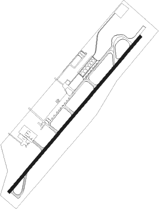
El Yopal - El Alcaravan
Airport details
| Country | Colombia |
| State | Casanare |
| Region | SK |
| Airspace | Bogota Ctr |
| Municipality | Yopal |
| Elevation | 1025ft (312m) |
| Timezone | GMT -5 |
| Coordinates | 5.31631, -72.38956 |
| Magnetic var | |
| Type | land |
| Available since | X-Plane v10.40 |
| ICAO code | SKYP |
| IATA code | EYP |
| FAA code | n/a |
Communication
| El Alcaravan ATIS | 127.700 |
| El Alcaravan FIS | 126.800 |
| El Alcaravan Approach | 126.800 |
| El Alcaravan Tower | 118.300 |
Approach frequencies
| ILS-cat-I | RW05 | 110.9 | 18.00mi |
| 3° GS | RW05 | 110.9 | 18.00mi |
Nearby beacons
| code | identifier | dist | bearing | frequency |
|---|---|---|---|---|
| EYP | EL YOPAL VOR/DME | 3.2 | 223° | 115.60 |
| MNI | MANI NDB | 35 | 174° | 322 |
| TDA | TRINIDAD NDB | 44.7 | 81° |
Departure and arrival routes
| Transition altitude | 18000ft |
| Transition level | 19000ft |
| SID end points | distance | outbound heading | |
|---|---|---|---|
| RW05 | |||
| REMI1B | 62mi | 29° | |
| OSIL1C | 59mi | 43° | |
| TOBS1B | 45mi | 81° | |
| VUGE1B | 45mi | 111° | |
| ANGU1B | 35mi | 174° | |
| UBNO1B | 57mi | 218° | |
| SUPN1A, SUPN1B | 23mi | 256° | |
| TITN1B | 32mi | 301° | |
| STAR starting points | distance | inbound heading | |
|---|---|---|---|
| RW05 | |||
| UBNO1C | 56.6 | 38° | |
| BUTI1A, BUTI1B | 45.2 | 51° | |
| TITN1A | 31.9 | 121° | |
| REMI1C | 61.7 | 209° | |
| OSIL1D | 59.2 | 223° | |
| TOBS1A | 44.7 | 261° | |
| VUGE1A | 44.6 | 291° | |
| ANGU1A | 35.0 | 354° | |
Disclaimer
The information on this website is not for real aviation. Use this data with the X-Plane flight simulator only! Data taken with kind consent from X-Plane 12 source code and data files. Content is subject to change without notice.
