Paramaribo - Zorg En Hoop
Airport details
| Country | Suriname |
| State | Paramaribo |
| Region | SM |
| Airspace | Paramaribo Ctr |
| Municipality | Beekhuizen |
| Elevation | 8ft (2m) |
| Timezone | GMT -3 |
| Coordinates | 5.81111, -55.19361 |
| Magnetic var | |
| Type | land |
| Available since | X-Plane v10.40 |
| ICAO code | SMZO |
| IATA code | ORG |
| FAA code | n/a |
Communication
| Zorg En Hoop SMZO TOWER | 118.700 |
Nearby Points of Interest:
Historic Inner City of Paramaribo
-Jodensavanne
Runway info
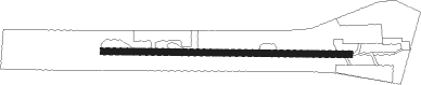
| Runway 11 / 29 | ||
| length | 754m (2474ft) | |
| bearing | 95° / 275° | |
| width | 20m (66ft) | |
| surface | asphalt | |
| displ threshold | 190m (623ft) / 0m (0ft) | |
| blast zone | 25m (82ft) / 0m (0ft) | |
Nearby beacons
| code | identifier | dist | bearing | frequency |
|---|---|---|---|---|
| ZY | ZANDERY VOR/DME | 21.6 | 178° | 114.30 |
Disclaimer
The information on this website is not for real aviation. Use this data with the X-Plane flight simulator only! Data taken with kind consent from X-Plane 12 source code and data files. Content is subject to change without notice.