Penedo
Airport details
| Country | Brazil |
| State | Alagoas |
| Region | SB |
| Airspace | Recife Ctr |
| Municipality | Penedo |
| Elevation | 196ft (60m) |
| Timezone | GMT -3 |
| Coordinates | -10.26722, -36.56694 |
| Magnetic var | |
| Type | land |
| Available since | X-Plane v10.40 |
| ICAO code | SNPE |
| IATA code | n/a |
| FAA code | n/a |
Communication
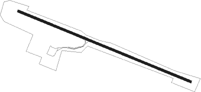
Runway info
| Runway 14 / 32 | ||
| length | 1369m (4491ft) | |
| bearing | 116° / 296° | |
| width | 17m (56ft) | |
| surface | asphalt | |
Nearby beacons
| code | identifier | dist | bearing | frequency |
|---|---|---|---|---|
| ARU | CAJU (ARACAJU) VOR/DME | 52.4 | 216° | 115.40 |
| MCE | ZUMBI (MACEIO) VOR/DME | 64.7 | 46° | 115.10 |
Disclaimer
The information on this website is not for real aviation. Use this data with the X-Plane flight simulator only! Data taken with kind consent from X-Plane 12 source code and data files. Content is subject to change without notice.