Regina
Airport details
| Country | France |
| State | French Guiana |
| Region | SO |
| Airspace | Cayenne Ctr |
| Municipality | Régina |
| Elevation | 20ft (6m) |
| Timezone | GMT -3 |
| Coordinates | 4.31346, -52.13272 |
| Magnetic var | |
| Type | land |
| Available since | X-Plane v10.40 |
| ICAO code | SOOR |
| IATA code | REI |
| FAA code | n/a |
Communication
Nearby Points of Interest:
Prefecture hotel of French Guiana
-Cayenne's Prison
-place Léopold-Héder
-hôpital Jean Martial
-Conseil général de Cayenne
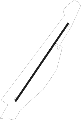
Runway info
| Runway 06 / 24 | ||
| length | 801m (2628ft) | |
| bearing | 39° / 219° | |
| width | 15m (50ft) | |
| surface | asphalt | |
Nearby beacons
| code | identifier | dist | bearing | frequency |
|---|---|---|---|---|
| CYR | FELIX EBOUE (CAYENNE) VOR/DME | 33.1 | 335° | 115.95 |
| FXC | FELIX EBOUE (CAYENNE) NDB | 33.6 | 336° | 327 |
| OIA | OIAPOQUE NDB | 33.7 | 144° | 340 |
Disclaimer
The information on this website is not for real aviation. Use this data with the X-Plane flight simulator only! Data taken with kind consent from X-Plane 12 source code and data files. Content is subject to change without notice.