Trujillo
Airport details
| Country | Peru |
| State | La Libertad |
| Region | SP |
| Airspace | Lima Ctr |
| Municipality | Huanchaco |
| Elevation | 104ft (32m) |
| Timezone | GMT -5 |
| Coordinates | -8.08171, -79.10865 |
| Magnetic var | |
| Type | land |
| Available since | X-Plane v10.40 |
| ICAO code | SPRU |
| IATA code | TRU |
| FAA code | n/a |
Communication
| Trujillo RDO | 126.900 |
| Trujillo Tower | 118.700 |
Approach frequencies
| ILS-cat-I | RW02 | 109.7 | 18.00mi |
| 3° GS | RW02 | 109.7 | 18.00mi |
Nearby Points of Interest:
Statua antropofica
-Huaca Cortada
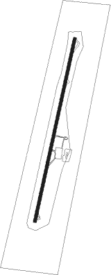
Runway info
| Runway 02 / 20 | ||
| length | 3040m (9974ft) | |
| bearing | 17° / 197° | |
| width | 44m (145ft) | |
| surface | asphalt | |
| blast zone | 62m (203ft) / 64m (210ft) | |
Nearby beacons
| code | identifier | dist | bearing | frequency |
|---|---|---|---|---|
| TRU | TRUJILLO VOR/DME | 0.4 | 213° | 116.30 |
| MAR | CAJAMARCA NDB | 67.4 | 33° | 300 |
Departure and arrival routes
| Transition altitude | 4500ft |
| SID end points | distance | outbound heading | |
|---|---|---|---|
| RW20 | |||
| RELU1F | 67mi | 33° | |
| VATE2F | 50mi | 63° | |
| ESMI1A | 73mi | 151° | |
| ESMI1B | 50mi | 151° | |
| STAR starting points | distance | inbound heading | |
|---|---|---|---|
| RW02 | |||
| VUGAL1 | 75.9 | 349° | |
| RW20 | |||
| RELU1A | 56.7 | 213° | |
| VATE2A | 49.7 | 243° | |
Instrument approach procedures
| runway | airway (heading) | route (dist, bearing) |
|---|---|---|
| RW20 | GENTU (332°) | GENTU RU756 (12mi, 338°) 3000ft |
| RW20 | IREPO (17°) | IREPO 3000ft LOKIX (4mi, 17°) 3000ft RU756 (8mi, 36°) 3000ft |
| RNAV | RU756 3000ft RU754 (4mi, 17°) 2200ft RU752 (3mi, 287°) 1000ft SPRU (3mi, 197°) 162ft RU982 (1mi, 197°) GENTU (13mi, 148°) GENTU (turn) |
Disclaimer
The information on this website is not for real aviation. Use this data with the X-Plane flight simulator only! Data taken with kind consent from X-Plane 12 source code and data files. Content is subject to change without notice.