Amambaí - Amambai
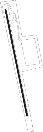
Airport details
| Country | Brazil |
| State | Mato Grosso do Sul |
| Region | |
| Airspace | Curitiba Ctr |
| Municipality | Amambai |
| Elevation | 1541ft (470m) |
| Timezone | GMT -4 |
| Coordinates | -23.13861, -55.20842 |
| Magnetic var | |
| Type | land |
| Available since | X-Plane v10.32 |
| ICAO code | SSAM |
| IATA code | n/a |
| FAA code | n/a |
Communication
Nearby beacons
| code | identifier | dist | bearing | frequency |
|---|---|---|---|---|
| PTP | PONTA PORA NDB | 44.8 | 320° | 340 |
| PJC | PEDRO JUAN CABALLERO NDB | 45.6 | 308° | 353 |
| DOU | DOURA (DOURADOS) NDB | 58.6 | 17° | 285 |
Disclaimer
The information on this website is not for real aviation. Use this data with the X-Plane flight simulator only! Data taken with kind consent from X-Plane 12 source code and data files. Content is subject to change without notice.