Rio Negrinho
Airport details
| Country | Brazil |
| State | Santa Catarina |
| Region | |
| Airspace | Curitiba Ctr |
| Municipality | Rio Negrinho |
| Elevation | 3081ft (939m) |
| Timezone | GMT -3 |
| Coordinates | -26.32128, -49.52127 |
| Magnetic var | |
| Type | land |
| Available since | X-Plane v10.40 |
| ICAO code | SSRN |
| IATA code | n/a |
| FAA code | n/a |
Communication
Nearby Points of Interest:
Ponte Metálica Rio Negro-Mafra
-Serra do Mar
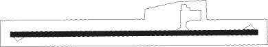
Runway info
| Runway 11 / 29 | ||
| length | 1202m (3944ft) | |
| bearing | 94° / 274° | |
| width | 24m (78ft) | |
| surface | asphalt | |
Nearby beacons
| code | identifier | dist | bearing | frequency |
|---|---|---|---|---|
| LAA | DME | 35.1 | 336° | 117.70 |
| JNV | JOINVILLE VOR/DME | 39.3 | 82° | 115.10 |
| CTB | CURITIBA VOR/DME | 51.1 | 24° | 116.50 |
| BCH | BACACHERI NDB | 57.3 | 18° | 300 |
| PGA | DME | 71.2 | 52° | 114.10 |
Disclaimer
The information on this website is not for real aviation. Use this data with the X-Plane flight simulator only! Data taken with kind consent from X-Plane 12 source code and data files. Content is subject to change without notice.