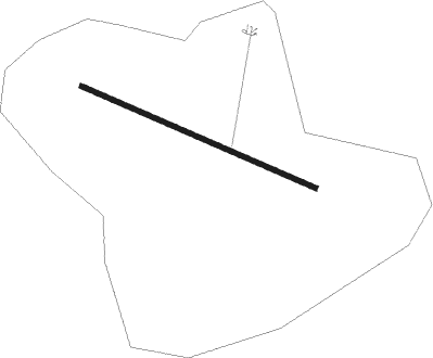
Colonia Del Sacramento - Laguna De Los Patos - Colonia
Airport details
| Country | Uruguay |
| State | Colonia |
| Region | SU |
| Airspace | Montevideo Ctr |
| Elevation | 0ft (0m) |
| Timezone | GMT -3 |
| Coordinates | -34.45139, -57.76694 |
| Magnetic var | |
| Type | land |
| Available since | X-Plane v10.40 |
| ICAO code | SUCA |
| IATA code | CYR |
| FAA code | n/a |
Communication
Nearby Points of Interest:
Colonia del Sacramento
-Casa de Gobierno, La Plata
-Hotel de Inmigrantes
-Laboratorio de Idiomas
-Plaza San Martín
-Joaquín V. González Public Library
-Galerías Pacífico
-Plaza de Mayo
-Palacio Haedo
-Numismatics Museum "Héctor Carlos Janson"
-Paz Palace
-Confitería Richmond
-El Club Atlético
-Librería de Ávila
-Palacio de la Legislatura de la Ciudad de Buenos Aires
-plaza Dorrego
-YPF building
-Confitería Ideal
-Bar El Federal
-Avenida de Mayo
-Café El Estaño 1880
-Fernández Anchorena Palace
-Petit Colón
-Confederación General Económica
-Café La Biela
Nearby beacons
| code | identifier | dist | bearing | frequency |
|---|---|---|---|---|
| ILM | QUILMES NDB | 28.1 | 241° | 210 |
| N | JORGE NEWBERY AEROPARQUE(BUENO NDB | 30.8 | 257° | 375 |
| PTA | LA PLATA NDB | 31.6 | 194° | 250 |
| PTA | LA PLATA VOR | 32.1 | 194° | 113.70 |
| P | JORGE NEWBERY AEROPARQUE(BUENO NDB | 33.7 | 262° | 280 |
| FDO | SAN FERNANDO VOR/DME | 40.4 | 270° | 114.40 |
| PAL | EL PALOMAR (BUENOS AIRES) VOR/DME | 42.9 | 259° | 115.20 |
| EZE | EZEIZA VOR/DME | 44 | 244° | 116.50 |
| OA | EZEIZA INTL MINISTRO PISTARINI NDB | 45 | 239° | 270 |
| C | EZEIZA INTL MINISTRO PISTARINI NDB | 45.1 | 245° | 305 |
| OC | EZEIZA INTL MINISTRO PISTARINI NDB | 47.7 | 248° | 330 |
| PDI | PUNTA INDIO NDB | 58.6 | 153° | 325 |
| PDI | PUNTA INDIO VOR/DME | 58.8 | 151° | 114.10 |
Instrument approach procedures
| runway | airway (heading) | route (dist, bearing) |
|---|---|---|
| RW13 | AKNUS (149°) | AKNUS GEBAR (5mi, 213°) 2000ft |
| RW13 | AKSET (80°) | AKSET GEBAR (5mi, 33°) 2000ft |
| RW13 | GEBAR (111°) | GEBAR 2000ft |
| RNAV | GEBAR 2000ft EGUPI (2mi, 114°) 1420ft SUCA (4mi, 110°) 116ft (3838mi, 59°) 2000ft GEBAR (3843mi, 239°) | |
| RW31 | EGDOK (295°) | EGDOK 3080ft |
| RNAV | EGDOK 3080ft KUGUG (6mi, 294°) 1520ft SUCA (5mi, 297°) 83ft (3838mi, 59°) 470ft (turn) 3000ft EGDOK (3831mi, 239°) |
Disclaimer
The information on this website is not for real aviation. Use this data with the X-Plane flight simulator only! Data taken with kind consent from X-Plane 12 source code and data files. Content is subject to change without notice.
