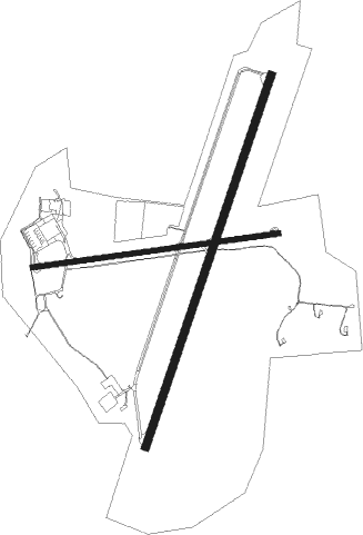
Durazno - Santa Bernardina Intl
Airport details
| Country | Uruguay |
| State | Durazno |
| Region | SU |
| Airspace | Montevideo Ctr |
| Elevation | 305ft (93m) |
| Timezone | GMT -3 |
| Coordinates | -33.35639, -56.49611 |
| Magnetic var | |
| Type | land |
| Available since | X-Plane v10.40 |
| ICAO code | SUDU |
| IATA code | DZO |
| FAA code | n/a |
Communication
| Santa Bernardina Intl DURAZNO Tower | 120.400 |
| Santa Bernardina Intl DURAZNO Tower | 126.200 |
| Santa Bernardina Intl DURAZNO Approach | 120.400 |
Approach frequencies
| ILS-cat-I | RW21 | 109.9 | 18.00mi |
| 3° GS | RW21 | 109.9 | 18.00mi |
Nearby Points of Interest:
Localidad Rupestre de Chamangá

Nearby beacons
| code | identifier | dist | bearing | frequency |
|---|---|---|---|---|
| DUR | DURAZNO VOR/DME | 0 | 23° | 117.50 |
| MP | DURAZNO NDB | 0.8 | 21° | 298 |
| BD | DURAZNO NDB | 2.3 | 209° | 277 |
| DO | DURAZNO NDB | 2.6 | 266° | 245 |
Instrument approach procedures
| runway | airway (heading) | route (dist, bearing) |
|---|---|---|
| RW10 | ALBES (87°) | ALBES 3000ft |
| RNAV | ALBES 3000ft DIDER (5mi, 87°) 1920ft SUDU (6mi, 86°) 326ft GEMOT (9mi, 88°) 3000ft GEMOT (turn) | |
| RW21 | BISOK (159°) | BISOK BUTSI (23mi, 141°) 4000ft |
| RW21 | BUTSI (207°) | BUTSI 3630ft |
| RW21 | MUMET (231°) | MUMET BUTSI (21mi, 242°) 4000ft |
| RNAV | BUTSI 3630ft ESORI (5mi, 207°) 1970ft SUDU (5mi, 206°) 355ft (3756mi, 59°) 710ft (turn) 2000ft BUTSI (3749mi, 240°) 3000ft BUTSI (turn) |
Disclaimer
The information on this website is not for real aviation. Use this data with the X-Plane flight simulator only! Data taken with kind consent from X-Plane 12 source code and data files. Content is subject to change without notice.