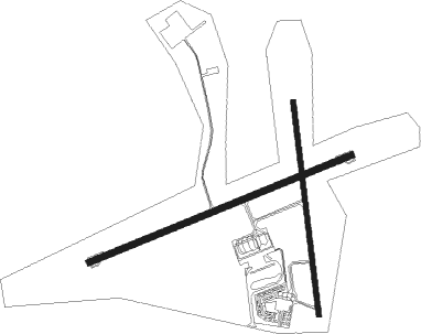
Punta Del Este - Cap. Corbeta C.a. Curbelo Intl
Airport details
| Country | Uruguay |
| State | Maldonado |
| Region | SU |
| Airspace | Montevideo Ctr |
| Elevation | 95ft (29m) |
| Timezone | GMT -3 |
| Coordinates | -34.86330, -55.09562 |
| Magnetic var | |
| Type | land |
| Available since | X-Plane v10.30 |
| ICAO code | SULS |
| IATA code | PDP |
| FAA code | n/a |
Communication
| Cap. Corbeta C.A. Curbelo Intl ATIS | 117.600 |
| Cap. Corbeta C.A. Curbelo Intl Tower | 118.300 |
| Cap. Corbeta C.A. Curbelo Intl Approach | 119.200 |
| Cap. Corbeta C.A. Curbelo Intl Departure | 119.200 |

Nearby beacons
| code | identifier | dist | bearing | frequency |
|---|---|---|---|---|
| LS | CAPITAN CURBELO (MALDONADO) NDB | 0.2 | 283° | 239 |
| LDS | CURBELO (MALDONADO) VOR/DME | 0.3 | 38° | 117.60 |
| CA | CARRASCO (MONTEVIDEO) NDB | 42 | 275° | 280 |
| AR | CARRASCO (MONTEVIDEO) NDB | 44.9 | 273° | 260 |
| CRR | CARRASCO (MONTEVIDEO) VOR/DME | 45.8 | 272° | 116.90 |
| CRO | CARRASCO (MONTEVIDEO) NDB | 46.1 | 273° | 305 |
| CAR | CARRASCO (MONTEVIDEO) NDB | 46.2 | 276° | 380 |
Departure and arrival routes
| Transition altitude | 3000ft |
| SID end points | distance | outbound heading | |
|---|---|---|---|
| RW08 | |||
| LUCI1D | 40mi | 256° | |
| STAR starting points | distance | inbound heading | |
|---|---|---|---|
| RW08 | |||
| DORV8A | 119.7 | 93° | |
Instrument approach procedures
| runway | airway (heading) | route (dist, bearing) |
|---|---|---|
| RW08 | ALBUM (77°) | ALBUM 3000ft |
| RNAV | ALBUM 3000ft ANDIB (8mi, 75°) 1500ft SULS (5mi, 80°) 142ft LOBIX (9mi, 73°) 3000ft LOBIX (turn) | |
| RW26 | LOBIX (253°) | LOBIX 2940ft |
| RNAV | LOBIX 2940ft PANUR (4mi, 255°) 1720ft KOVIT (2mi, 255°) 920ft SULS (3mi, 248°) 119ft ALBUM (13mi, 257°) 3000ft ALBUM (turn) |
Holding patterns
| STAR name | hold at | type | turn | heading* | altitude | leg | speed limit |
|---|---|---|---|---|---|---|---|
| DORV8A | KUDOG | VHF | left | 284 (104)° | DME 5.0mi | ICAO rules | |
| *) magnetic outbound (inbound) holding course | |||||||
Disclaimer
The information on this website is not for real aviation. Use this data with the X-Plane flight simulator only! Data taken with kind consent from X-Plane 12 source code and data files. Content is subject to change without notice.