Barcelona - Genral Jose Antonio Intl
Airport details
| Country | Venezuela |
| State | Anzoategui State |
| Region | SV |
| Airspace | Maiquetia Ctr |
| Municipality | Barcelona |
| Elevation | 24ft (7m) |
| Timezone | GMT -4 |
| Coordinates | 10.10429, -64.68353 |
| Magnetic var | |
| Type | land |
| Available since | X-Plane v10.40 |
| ICAO code | SVBC |
| IATA code | BLA |
| FAA code | n/a |
Communication
| Genral Jose Antonio Intl ATIS | 127.900 |
| Genral Jose Antonio Intl Ground Control | 121.900 |
| Genral Jose Antonio Intl BARCELONA Tower | 118.700 |
| Genral Jose Antonio Intl BARCELONA Approach | 119.100 |
| Genral Jose Antonio Intl BARCELONA Approach | 121.100 |
Approach frequencies
| ILS-cat-I | RW15 | 110.9 | 18.00mi |
| 3° GS | RW15 | 110.9 | 18.00mi |
Nearby Points of Interest:
St. Christopher's Cathedral
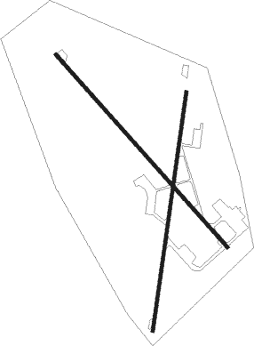
Runway info
Runway 15 / 33  | ||
| length | 3014m (9888ft) | |
| bearing | 142° / 322° | |
| width | 40m (130ft) | |
| surface | asphalt | |
| blast zone | 152m (499ft) / 0m (0ft) | |
| Runway 02 / 20 | ||
| length | 2810m (9219ft) | |
| bearing | 13° / 193° | |
| width | 40m (130ft) | |
| surface | asphalt | |
| blast zone | 0m (0ft) / 255m (837ft) | |
Nearby beacons
| code | identifier | dist | bearing | frequency |
|---|---|---|---|---|
| BNA | BARCELONA VOR/DME | 0.6 | 320° | 115.90 |
| CUM | CUMANA VOR/DME | 38.1 | 58° | 113.30 |
| URC | URICA NDB | 47 | 120° | 330 |
| MT | GILES NDB | 60.8 | 39° | 218 |
| MTA | MARGARITA (DEL CARIBE) VOR/DME | 64.9 | 42° | 114.10 |
Departure and arrival routes
| Transition altitude | 5000ft |
| SID end points | distance | outbound heading | |
|---|---|---|---|
| RW02 | |||
| ARVEX1 | 23mi | 19° | |
| RW15 | |||
| GENKA1 | 23mi | 19° | |
| RW20 | |||
| KIBOR1 | 23mi | 19° | |
| RW33 | |||
| ESGIR1, PORGA2 | 23mi | 19° | |
| BNA2 | 38mi | 155° | |
| GEMAP2 | 46mi | 268° | |
| ISULA2 | 42mi | 290° | |
Instrument approach procedures
| runway | airway (heading) | route (dist, bearing) |
|---|---|---|
| RW15-Y | CUM (238°) | CUM BOGAM (39mi, 259°) 3000ft ANRAK (5mi, 187°) 3000ft |
| RW15-Y | GEMAP (88°) | GEMAP DIDES (36mi, 74°) 3000ft ANRAK (5mi, 98°) 3000ft |
| RW15-Y | MEXOT (143°) | MEXOT DIDES (16mi, 156°) 3000ft ANRAK (5mi, 98°) 3000ft |
| RNAV | ANRAK 3000ft MARUS (3mi, 142°) 2000ft SVBC (7mi, 141°) 66ft EKEGO (turn) DIDES (15mi, 308°) 4000ft DIDES (turn) | |
| RW15-Z | CUM (238°) | CUM BOGAM (39mi, 259°) 3000ft ANRAK (5mi, 187°) 3000ft |
| RW15-Z | GEMAP (88°) | GEMAP DIDES (36mi, 74°) 3000ft ANRAK (5mi, 98°) 3000ft |
| RW15-Z | MEXOT (143°) | MEXOT DIDES (16mi, 156°) 3000ft ANRAK (5mi, 98°) 3000ft |
| RNAV | ANRAK 3000ft MARUS (3mi, 142°) 2000ft SVBC (7mi, 141°) 66ft EKEGO (turn) DIDES (15mi, 308°) 4000ft DIDES (turn) | |
| RW20 | CUM (238°) | CUM RAFAL (28mi, 250°) 2500ft DOBKU (5mi, 237°) 2500ft |
| RW20 | MEXOT (143°) | MEXOT PAMAS (20mi, 124°) 2500ft DOBKU (5mi, 148°) 2500ft |
| RNAV | DOBKU 2500ft ENTIS (3mi, 193°) 1500ft SVBC (5mi, 189°) 68ft GUXIR (turn) PAMAS (13mi, 357°) 3500ft PAMAS (turn) | |
| RW33-Y | GEBAL (4°) | GEBAL ESBOL (28mi, 15°) 3100ft GEMEL (6mi, 356°) 3100ft |
| RW33-Y | MTA (222°) | MTA KAKAM (40mi, 210°) 5000ft OSARI (21mi, 209°) 5000ft DEXUR (6mi, 212°) 3400ft GEMEL (6mi, 302°) 3100ft |
| RW33-Y | PEDRI (281°) | PEDRI UMGAL (8mi, 248°) 5900ft DEXUR (6mi, 248°) 3400ft GEMEL (6mi, 302°) 3100ft |
| RNAV | GEMEL 3100ft ITASU (2mi, 322°) 2100ft SVBC (5mi, 324°) 78ft LOGEL (1mi, 316°) ESBOL (15mi, 156°) 4100ft ESBOL (turn) | |
| RW33-Z | GEBAL (4°) | GEBAL ESBOL (28mi, 15°) 3100ft GEMEL (6mi, 356°) 3100ft |
| RW33-Z | MTA (222°) | MTA KAKAM (40mi, 210°) 5000ft OSARI (21mi, 209°) 5000ft DEXUR (6mi, 212°) 3400ft GEMEL (6mi, 302°) 3100ft |
| RW33-Z | PEDRI (281°) | PEDRI UMGAL (8mi, 248°) 5900ft DEXUR (6mi, 248°) 3400ft GEMEL (6mi, 302°) 3100ft |
| RNAV | GEMEL 3100ft ITASU (2mi, 322°) 2100ft SVBC (5mi, 324°) 78ft LOGEL (1mi, 316°) ESBOL (15mi, 156°) 4100ft ESBOL (turn) |
Disclaimer
The information on this website is not for real aviation. Use this data with the X-Plane flight simulator only! Data taken with kind consent from X-Plane 12 source code and data files. Content is subject to change without notice.