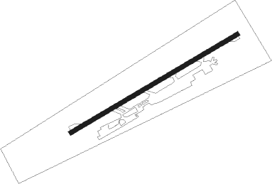
Puerto Ordaz-ciudad Guayana - General Manuel Carlos Piar
Airport details
| Country | Venezuela |
| State | Bolivar State |
| Region | SV |
| Airspace | Maiquetia Ctr |
| Municipality | Ciudad Guayana |
| Elevation | 472ft (144m) |
| Timezone | GMT -4 |
| Coordinates | 8.28659, -62.76074 |
| Magnetic var | |
| Type | land |
| Available since | X-Plane v10.40 |
| ICAO code | SVPR |
| IATA code | PZO |
| FAA code | n/a |
Communication
| General Manuel Carlos Piar Ground Control | 121.900 |
| General Manuel Carlos Piar GUAYANA Tower | 118.000 |
Nearby beacons
| code | identifier | dist | bearing | frequency |
|---|---|---|---|---|
| GNA | GUAYANA VOR/DME | 0.6 | 49° | 114.70 |
| GRY | TOCOMITA NDB | 37.5 | 211° | 255 |
| CBL | CIUDAD BOLIVAR VOR/DME | 46.9 | 258° | 115.10 |
| TUC | TUCUPITA NDB | 62 | 40° | 225 |
Departure and arrival routes
| Transition altitude | 5000ft |
| SID end points | distance | outbound heading | |
|---|---|---|---|
| RW08 | |||
| TOBLA1 | 80mi | 100° | |
| EPANA1 | 71mi | 182° | |
| EPAN1A | 122mi | 183° | |
| CBL1 | 47mi | 258° | |
| MIGED1 | 44mi | 296° | |
| GNA1 | 91mi | 345° | |
| RW26 | |||
| EPAN1A | 122mi | 183° | |
| CBL1 | 47mi | 258° | |
| MIGED1 | 44mi | 296° | |
| STAR starting points | distance | inbound heading | |
|---|---|---|---|
| RW08 | |||
| EGAXI1 | 71.0 | 2° | |
| KILOM1 | 46.9 | 78° | |
| MIGED1 | 43.5 | 116° | |
| ITAMA1 | 52.8 | 139° | |
| MUN1 | 90.5 | 165° | |
| TOBLA1 | 80.3 | 280° | |
| DALVA1 | 79.7 | 340° | |
Instrument approach procedures
| runway | airway (heading) | route (dist, bearing) |
|---|---|---|
| RW08-Y | EPANA (2°) | EPANA EDMAS (23mi, 336°) 3300ft GEKEN (5mi, 20°) 3300ft |
| RW08-Y | SOM (115°) | SOM MIGED (48mi, 114°) 3300ft ASUDO (34mi, 129°) 3300ft GEKEN (5mi, 108°) 3300ft |
| RNAV | GEKEN 3300ft GIDLO (4mi, 64°) 1900ft SVPR (5mi, 65°) 493ft IRILA (turn) ASUDO (14mi, 259°) 4300ft ASUDO (turn) | |
| RW08-Z | EPANA (2°) | EPANA EDMAS (23mi, 336°) 3300ft GEKEN (5mi, 20°) 3300ft |
| RW08-Z | SOM (115°) | SOM MIGED (48mi, 114°) 3300ft ASUDO (34mi, 129°) 3300ft GEKEN (5mi, 108°) 3300ft |
| RNAV | GEKEN 3300ft GIDLO (4mi, 64°) 1900ft SVPR (5mi, 65°) 493ft IRILA (turn) ASUDO (14mi, 259°) 4300ft ASUDO (turn) | |
| RW26-Y | EPANA (2°) | EPANA ESUNO (30mi, 25°) 3300ft LIVEM (5mi, 17°) 3300ft LODAR (5mi, 288°) 3300ft |
| RW26-Y | SOM (115°) | SOM MIGED (48mi, 114°) 3300ft ISLIM (35mi, 90°) 3300ft KADUR (18mi, 126°) 3300ft LODAR (5mi, 200°) 3300ft |
| RNAV | LODAR 3300ft MIGEK (4mi, 244°) 1900ft SVPR (5mi, 243°) 523ft OBGOL (turn) KADUR (14mi, 49°) 4300ft KADUR (turn) | |
| RW26-Z | EPANA (2°) | EPANA ESUNO (30mi, 25°) 3300ft LIVEM (5mi, 17°) 3300ft LODAR (5mi, 288°) 3300ft |
| RW26-Z | SOM (115°) | SOM MIGED (48mi, 114°) 3300ft ISLIM (35mi, 90°) 3300ft KADUR (18mi, 126°) 3300ft LODAR (5mi, 200°) 3300ft |
| RNAV | LODAR 3300ft MIGEK (4mi, 244°) 1900ft SVPR (5mi, 243°) 523ft OBGOL (turn) KADUR (14mi, 49°) 4300ft KADUR (turn) |
Holding patterns
| STAR name | hold at | type | turn | heading* | altitude | leg | speed limit |
|---|---|---|---|---|---|---|---|
| KILOM1 | KILOM | VHF | left | 271 (91)° | > 4000ft | 1.0min timed | ICAO rules |
| MIGED1 | MIGED | VHF | left | 309 (129)° | > 4000ft | 1.0min timed | ICAO rules |
| MUN1 | GNA | NDB | left | 99 (279)° | > 4000ft | 1.0min timed | ICAO rules |
| TOBLA1 | GNA | NDB | left | 99 (279)° | > 4000ft | 1.0min timed | ICAO rules |
| *) magnetic outbound (inbound) holding course | |||||||
Disclaimer
The information on this website is not for real aviation. Use this data with the X-Plane flight simulator only! Data taken with kind consent from X-Plane 12 source code and data files. Content is subject to change without notice.
