Valera - Antonio Nicolas Briceño
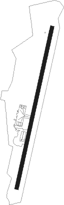
Airport details
| Country | Venezuela |
| State | Trujillo State |
| Region | SV |
| Airspace | Maiquetia Ctr |
| Municipality | Parroquia Carvajal |
| Elevation | 1893ft (577m) |
| Timezone | GMT -4 |
| Coordinates | 9.34056, -70.58417 |
| Magnetic var | |
| Type | land |
| Available since | X-Plane v10.32 |
| ICAO code | SVVL |
| IATA code | VLV |
| FAA code | n/a |
Communication
| Antonio Nicolas Briceño Ground Control | 121.900 |
| Antonio Nicolas Briceño VALERA Tower | 122.800 |
Nearby Points of Interest:
Teta de Niquitao-Guirigay Natural Monument
Nearby beacons
| code | identifier | dist | bearing | frequency |
|---|---|---|---|---|
| VRA | VALERA VOR/DME | 5.2 | 17° | 114.40 |
| BNS | BARINAS VOR/DME | 48.5 | 153° | 117.50 |
| COR | CARORA VOR/DME | 58.7 | 32° | 112.70 |
Instrument approach procedures
| runway | airway (heading) | route (dist, bearing) |
|---|---|---|
| RW21 | ASULI (146°) | ASULI KABIR (16mi, 98°) 6000ft DONTA (7mi, 159°) 6000ft |
| RW21 | ERIXO (160°) | ERIXO ANPIR (7mi, 5°) 6000ft KABIR (5mi, 70°) 6000ft DONTA (7mi, 159°) 6000ft |
| RW21 | JENDE (208°) | JENDE 8000ft DONTA (5mi, 237°) 6000ft |
| RNAV | DONTA 6000ft ALBUL (8mi, 197°) 3400ft SVVL (5mi, 197°) 1853ft KABIR (19mi, 4°) 7000ft KABIR (turn) |
Disclaimer
The information on this website is not for real aviation. Use this data with the X-Plane flight simulator only! Data taken with kind consent from X-Plane 12 source code and data files. Content is subject to change without notice.