Formosa
Airport details
| Country | Brazil |
| State | Goiás |
| Region | SB |
| Airspace | Brasilia Ctr |
| Municipality | Formosa |
| Elevation | 3166ft (965m) |
| Timezone | GMT -3 |
| Coordinates | -15.55611, -47.34528 |
| Magnetic var | |
| Type | land |
| Available since | X-Plane v10.40 |
| ICAO code | SWFR |
| IATA code | n/a |
| FAA code | n/a |
Communication
| Formosa CTAF | 130.000 |
Nearby Points of Interest:
Palácio do Jaburu
-Palácio do Planalto
-Museu da Cidade
-Itamaraty Palace
-Pilot Plan of Brasília
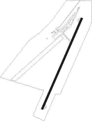
Runway info
| Runway 05 / 23 | ||
| length | 1408m (4619ft) | |
| bearing | 29° / 209° | |
| width | 30m (98ft) | |
| surface | asphalt | |
| blast zone | 58m (190ft) / 58m (190ft) | |
Nearby beacons
| code | identifier | dist | bearing | frequency |
|---|---|---|---|---|
| FSA | FORMOSA VOR/DME | 0 | 285° | 112.70 |
| VJK | KUBITSCHEK (BRASILIA) VOR/DME | 37 | 241° | 117.50 |
| BSI | BRASILIA VOR/DME | 43.4 | 245° | 116.30 |
| LUZ | LUZIANIA VOR/DME | 55.6 | 222° | 113.10 |
Disclaimer
The information on this website is not for real aviation. Use this data with the X-Plane flight simulator only! Data taken with kind consent from X-Plane 12 source code and data files. Content is subject to change without notice.