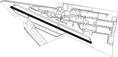
Goiânia - Aerodromo Nacional De Aviacao
Airport details
| Country | Brazil |
| State | Goiás |
| Region | SB |
| Airspace | Brasilia Ctr |
| Municipality | Goiânia |
| Elevation | 2707ft (825m) |
| Timezone | GMT -3 |
| Coordinates | -16.62698, -49.34466 |
| Magnetic var | |
| Type | land |
| Available since | X-Plane v10.30 |
| ICAO code | SWNV |
| IATA code | n/a |
| FAA code | n/a |
Communication
| Aerodromo Nacional de Aviacao UNICOM | 122.800 |
Nearby Points of Interest:
Praça Cívica
-Parish Church of Our Lady of the Rosary
Nearby beacons
| code | identifier | dist | bearing | frequency |
|---|---|---|---|---|
| GNV | GOIANIA VOR/DME | 7.7 | 96° | 115.90 |
| SBG | SANTA BARBARA (ANAPOLIS) NDB | 20.5 | 277° | 230 |
| APO | ANAPOLIS VOR/DME | 31.1 | 44° | 116.80 |
Disclaimer
The information on this website is not for real aviation. Use this data with the X-Plane flight simulator only! Data taken with kind consent from X-Plane 12 source code and data files. Content is subject to change without notice.